What to photograph in the Vercors massif?
Vercors photography guide
In the Vercors, you can photograph an isolated silhouette, the scale of a vast plateau, a ridge connected to inhabited landscapes, a road caught in a cliff or the material of karst relief.
These images require neither the same sector, nor the same depth, nor the same level of commitment. The useful choice is therefore to decide what should structure the photograph before choosing a place.
Read the territory
Five image constructions distinguish the Vercors
Limestone unifies the massif, but the photograph changes depending on whether priority goes to a form, a space or landscape depth.
The silhouette stands apart
At Mont Aiguille, the isolation of the butte and the space left around its profile give the image its strength. A village, field or distant range can provide scale without taking priority.
Space becomes the subject
Around Grand Veymont and the Hauts-Plateaux, the summit matters together with alpine pastures, sparse forests, cliffs and the duration of the progression. The frame should convey continuity, not merely point to the highest summit.
The ridge dialogues with inhabited territory
In northern Vercors, Moucherotte and Pic Saint-Michel can dominate Grenoble, Val de Lans or the Alpine ranges. Woods, pastures and lapiaz build planes between the ridge and that wider background.
The road reveals verticality
At Combe Laval, the road cut into the wall gives a human measure to the reculée. Cliff, forest, mist and the depth of Royans can then matter as much as the structure itself.
The plateau is read through transitions
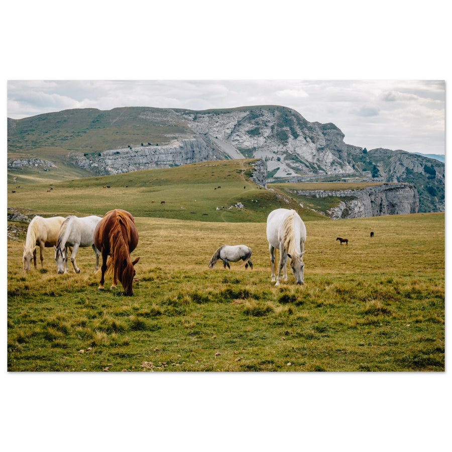
Font d’Urle exposes karst, dolines, lapiaz and cliff edge; Ambel adds a mosaic of grasslands, clearings and forests. Here, a forest edge or break in terrain can carry the image better than a summit.

Photographic evidence
Isolation can carry the entire composition
Mont Aiguille occupies a small part of the frame, but its profile remains the anchor. Sky and distant ranges amplify the space instead of diluting the subject.
Photography: Sander van der WerfView the Mont Aiguille workChoose by intention
What image do you want to build?
Start from the result you want. Each choice leads to a project where the visual relationship is developed and anchored in the terrain.
Give an isolated silhouette room and use the Trièves for scale. Choose Mont Aiguille
Make the extent, pastures and progression matter as much as the high point. Choose Grand Veymont and the Hauts-Plateaux
Build several planes between pastures, Val de Lans, Grenoble and Alpine ranges. Choose northern Vercors
Use the structure to reveal the scale of the reculée, forest and clouds. Choose Combe Laval
Look for karst breaks, grasslands and forest edges rather than a single summit. Choose Font d’Urle and Ambel
Five active projects
Compare subjects before choosing the sector
Each guide answers a distinct photographic question. The order below moves from isolated silhouette to plateau landscapes.
Mont Aiguille
Silhouette · scale · TrièvesDistance and position change the profile, the place of the village and the relationship to nearby relief. The project is about deciding what accompanies the silhouette without stealing its hierarchy.
Grand Veymont and the Hauts-Plateaux
Summit · extent · autonomyGrand Veymont visually links the Trièves and the Hauts-Plateaux. Plateau lines, pastures and cliffs need enough room to convey that scale.
Northern Vercors
Ridges · pastures · inhabited territoryMoucherotte, Pic Saint-Michel, woods and lapiaz offer several ways to connect the ridges to Grenoble, Val de Lans or the Alpine ranges.
Combe Laval
Road · walls · forestThe road provides scale, but the photograph becomes richer when walls, forest, Royans or cloud layers also build the reculée.
Font d’Urle and Ambel
Karst · grasslands · forest edgesFont d’Urle offers an open, rocky register bordered by cliffs; Ambel adds transitions between broad grasslands, clearings and forests.
Photographic evidence
The ridge can remain legible without closing the landscape
At Pic Saint-Michel, alpine pasture and groups of trees create a progression towards the rock. The image belongs to northern Vercors before being a simple summit portrait.
Photography: Pierre ThiavilleView the Pic Saint-Michel work
Broaden without losing the thread
Two useful extensions towards the south
These subjects complement the reading of the massif but replace none of the five main projects above.
Glandasse and Archiane
Large walls and valleys open a more southern reading of the limestone. They become relevant when a series goes beyond the five main projects without turning them into an automatic new entry.
Col de Rousset and Diois
The descent towards Diois stages a transition between Vercors cliffs, valleys and southern relief. The interest lies in this geographic shift, not in collecting one more summit.
Change project at the right time
Conditions should change the subject, not only the schedule
When the planned structure disappears, choose the relationship that remains genuinely visible.
Stop forcing the portrait
If the profile of Mont Aiguille or Grand Veymont disappears, look for a road, forest edge, foreground relief or valley depth that still exists in the image.
Reduce the space to a legible relationship
A large empty plateau is not enough. Use an edge, doline, grass line, forest edge or transition between rock and forest.
Change sector before changing the image
The Hauts-Plateaux, northern cliffs, Font d’Urle, Ambel and Combe Laval do not all have the same regime. Access or protection constraints should lead to an authorized, prepared project.
Choose the landscape before the scenario
There is no universal season or time for the whole Vercors. Snow, mist, autumn colour or grazing light matter only if they reinforce the structure of the chosen subject.
The exact perimeter matters more than the massif name
The Vercors includes a national reserve, sensitive natural areas, protection orders and pastoral sectors. Always check the precise route, regulations and current conditions.

Photographic Plan B
Clouds can reveal the reculée
When distant horizons close, the road, cliff and cloud layer still form a complete relationship. Changing subject becomes a decision, not a consolation prize.
Photography: Louise.sView the Combe Laval workPrepare without freezing
Separate landscape reading from information that must be rechecked
The properties of the relief explain why a project works. Access, water, weather, sensitive zones and some rules can change or depend on the exact sector: they must be reviewed before every outing.
Check before you go
- road access, parking and route condition;
- weather, visibility and risks specific to the chosen relief;
- water availability and the level of autonomy required;
- the protected perimeter crossed, its rules and sensitive zones.
Official sources
Vercors photo wall art
Find works from the massif after identifying the photographic relationships they explore.