The Most Beautiful Glaciers in the French Alps
A glacier is more than a great mass of white ice. In the French Alps, it can take the form of a deep valley bordered by moraines, a cascade of seracs descending towards the forests, a broad high-altitude basin, an ice front above a lake or, conversely, an almost entirely rocky landscape where ice disappears beneath debris.
This selection brings together twelve glaciers or glacial areas in the French Alps, chosen for their different visual signatures. It does not seek to establish a universal “top 12”: the Mer de Glace tells a different story from Bossons–Taconnaz, Grand Méan serves a different project from Glacier Noir, and the Grande Motte embraces a developed landscape absent from Talèfre.
The aim is to help you choose a scene according to what you truly want to show: monumental scale, seracs, a large basin, a high-altitude panorama, ice and rock, a proglacial lake, a developed landscape or more discreet landforms.
The order serves comparison; it ranks neither beauty nor scientific importance.
The actual unit being compared is stated to avoid false equivalents.
The level of commitment helps you choose; route descriptions and mountaineering remain separate.
An AAM work may illustrate a place, but never determines its eligibility.
What is really being compared
Not all entries have exactly the same geographical scale. The Mer de Glace, Argentière, Géant, Grande Motte, Gébroulaz, Girose, Glacier Blanc, Grand Méan and Glacier Noir are treated as identified glaciers. Bossons–Taconnaz is a visual area here: two distinct glaciers whose relationship becomes especially readable around La Jonction. Talèfre is approached as a glacial basin. Les Rouies is considered a glacial area or plateau, because that great expanse of ice structures the scene.
This precision avoids artificially comparing different objects as though they were equivalent. Above all, it returns us to the right question: what glacial scene do you want to see and photograph?
The evidence varies by profile. For several scenes — notably the Mer de Glace, Bossons–Taconnaz, Talèfre, Grande Motte, Gébroulaz, Glacier Blanc and Les Rouies — AAM photographs are clearly tied to the place, supplemented by official sources where facts change. For Argentière, Géant, Girose, Grand Méan and Glacier Noir, I rely first on available documentation and never present something as first-hand field experience when it is not.
Three simple ways to read a glacier in the landscape
1. The visible surface
Glacier Blanc shows largely exposed ice; Glacier Noir is mostly covered by debris and moraines. Both are glaciers, but they produce radically different images.
2. The overall shape
Glacial valley or tongue, serac cascade, basin or cirque, plateau and high glacier: the Mer de Glace reads through depth, Bossons–Taconnaz through slope, Talèfre through its cirque and Les Rouies through its breadth.
3. The relationship with relief
Moraines, needles, walls, a proglacial lake, forest or infrastructure can matter as much as the ice. The lake distinguishes Grand Méan; development is part of the Grande Motte; rock defines Glacier Noir.
Which glacier should you choose at a glance?
| Glacier or area | Visual signature | Main viewpoint | Commitment | Light / season | Main compromise |
|---|---|---|---|---|---|
| Mer de Glace | Great valley, moraines, needles and depth | Valley viewpoint / Montenvers | Low to moderate for the main observation point | Raking light for relief; moraines clearer when less hidden by snow | Infrastructure, visitor numbers and very visible retreat |
| Bossons–Taconnaz area | Ice cascades, seracs and slopes descending to the valley | Valley, slopes and ground-based views | Observation possible without travelling on ice | Side light for volume | Serac danger when seeking to get closer; two-part unit to explain |
| Argentière glacier | Broad basin beneath steep walls | Valley, slope or high point depending on access | Varies with the chosen point | Clear air for scale; raking light for relief | Changing access and infrastructure |
| Glacier Blanc | Exposed ice beneath the Barre, Dôme and Pelvoux | Trail / refuge area | High-altitude hike | Strong definition when snow does not erase the forms | Visitor numbers and currently changeable access |
| Géant glacier | A white world at very high altitude, crevasses and great volumes | Aiguille du Midi area | Altitude must be taken seriously; observation possible from a viewpoint | Diffuse or raking light depending on the texture sought | High altitude and infrastructure |
| Talèfre basin | Wild cirque, seracs and needles | High mountains | High | Very expressive raking light | Demanding access and rapidly changing conditions |
| Gébroulaz glacier | The broad scale of the Vanoise beneath high domes | Mountain viewpoints | Moderate to high depending on the area | Sunrise/sunset useful for bringing out relief | Remoteness and often distant observation |
| Girose glacier | Ice and rock beneath La Meije | Col des Ruillans / high points | High altitude | Rock–ice contrast and raking light | Changing infrastructure; the glacier can be less distinct than a general view of La Meije |
| Les Rouies area | A great expanse of ice and human scale | High mountains / ground-based views from Valgaudemar | High if seeking to reach the glacier | Low light to convey the breadth | Do not confuse observation with a glacier climb |
| Grande Motte glacier | High-altitude glacier, summit and developed landscape | Distant view or lift access depending on the season | Variable | Snow and lift operation strongly change how the scene reads | Visible infrastructure and a less wild atmosphere |
| Grand Méan glacier | Ice front above a lake, with possible floating blocks | Lakeshore / high-altitude hike | Demanding | A rapidly changing ice–water relationship | Long approach; final section unmarked according to the current official itinerary |
| Glacier Noir | Ice hidden by debris, moraines and a rocky landscape | Trail / moraine | High-altitude hike | Side light to reveal volume and materials | Less visible ice; access to Pré de Madame Carle highly changeable in 2026 |
This table does not give a score. It helps you quickly eliminate glaciers that do not match your intention.
Which glacier should you choose for each type of scene?
Valley and depth
The Mer de Glace remains the clearest scene if you want the glacier to organise the full depth of the landscape.
Seracs and verticality
Bossons–Taconnaz changes the register: slope, breaks and proximity to the valley make the ice much more vertical.
A broad basin
Argentière is better suited to a broad high-mountain scene beneath the Aiguille Verte, Les Droites, Les Courtes and the Aiguille d’Argentière.
A glacial world viewed from above
The Géant glacier makes sense if you seek an almost entirely white and rocky world from a very high-altitude viewpoint.
A wild cirque
Talèfre favours the enclosed basin, seracs, needles and a true high-mountain atmosphere.
A developed glacier
The Grande Motte is the right counterpoint if the relationship between glacier, summit and resort infrastructure is part of the subject.
Classic white ice
Glacier Blanc is particularly instructive for reading exposed ice within an Écrins valley.
Lake and glacier front
Grand Méan offers a rare relationship between an ice front and a proglacial lake.
A rocky glacier
Glacier Noir, by contrast, shows a glacier largely covered by debris and moraines.
Observing a glacier is not walking on a glacier
1. Valleys, cascades and great glacial volumes
These four scenes reveal substantial glacial volumes from a valley, slope, viewpoint or trail. Their interest lies precisely in four different readings: depth, verticality, the breadth of a basin and exposed ice.
Mer de Glace — the depth of a glacial valley
The Mer de Glace immediately gives the landscape scale. From the Montenvers area, the eye travels up a glacial valley framed by needles. Moraines, rocky slopes and the length of the perspective matter as much as the ice itself.
It is particularly suitable if you want the glacier to structure the whole composition. Raking light strengthens relief; diffuse light retains more detail. When snow covers the moraines less, the glacial structure often becomes easier to read, without that constituting a universal calendar.
This accessibility has a trade-off: infrastructure and visitor numbers are part of the experience, and retreat has profoundly changed the scene from historic viewpoints. Any figures describing this change must be dated and sourced.
The Mer de Glace is more suitable than Argentière if you want a composition with clear depth from a viewpoint. Argentière appears more open; Bossons–Taconnaz is much more vertical.

A glacial valley that gives the full sense of scale
The glacier tongue, moraines and needles organise the valley’s depth.
Photograph: Pierre Thiaville
View the Mer de Glace photo printPhotographing the Mer de Glace from Montenvers.
Bossons–Taconnaz area — ice cascades facing the valley
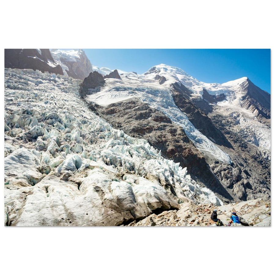
Bossons and Taconnaz are two distinct glaciers. They are brought together here as a visual area because their ice cascades descend the Mont-Blanc slopes and their relationship becomes particularly readable around La Jonction.
The area stands out for its seracs, slope and sense of ice tipping towards the valley. Its forms are more vertical than on the Mer de Glace and more directly set against forests and inhabited areas.
Side or raking light helps reveal changes in slope and the volume of the seracs. Spectacular aesthetics must never trivialise danger, however: the scene can be photographed from points on land without recommending an approach to the ice.
The interpretation therefore rests on the relationship between the two glaciers and the mountainside’s slope, not on a generic image of fractured ice.

La Jonction makes both glaciers readable together
The slope, seracs and relationship between Bossons and Taconnaz create a different scene from a classic glacial valley.
Photograph: Florian Augustin
View the photo print of La Jonction between the Bossons and Taconnaz glaciersArgentière glacier — a broad high-mountain basin
The Argentière glacier stands out less for a single form than for the breadth of its basin beneath the Aiguille Verte, Les Droites, Les Courtes and the Aiguille d’Argentière. Where the Mer de Glace reads as a valley guiding the eye, Argentière opens up the field and conveys a more direct sense of the high mountains.
It is relevant if you seek a large glacial volume without the very vertical staging of Les Bossons. The best viewpoints, however, depend heavily on available access and the area’s infrastructure; it would be unwise to fix one as a universal solution.
The trade-off is a scene less immediately graphic than a serac cascade or a glacier front in a lake. The comparison must therefore remain centred on the broad basin and its walls.
Glacier Blanc — a classic reading of exposed ice
In the Écrins, Glacier Blanc is a particularly clear reference for understanding what many people imagine when they think of an Alpine glacier: a visible mass of ice read alongside the valley, streams and moraines from the surrounding terrain. The Barre and Dôme des Écrins, together with Le Pelvoux in the surrounding landscape, give the glacier an immediately mountainous scale.
Its interest comes from that clarity. It works well as a comparison with Glacier Noir: one largely exposes the ice, while the other conceals it beneath rocky material.
In 2026, uncertainty mainly concerns access. Following floods in late summer, Écrins National Park reported major disruption towards Pré de Madame Carle. This information must be checked again immediately before any outing.
This reading works all the better when the glacier remains identifiable within the valley, streams and moraines.

Immediately readable exposed ice
The glacier remains identifiable among the relief of the Écrins, making it a useful counterpoint to Glacier Noir.
Photograph: Marisa Estivill
View the Glacier Blanc in the Écrins photo print2. High glaciers, cirques and high-mountain plateaus
Within this family, altitude, cirque, basin or plateau change the perception of ice. The scenes are rockier and levels of commitment differ greatly: grouping them aids interpretation, rather than defining a scientific typology.
Géant glacier — looking at a glacier from very high above
The Géant glacier chiefly changes the viewpoint. It does not reproduce the Mer de Glace’s valley reading: from the Aiguille du Midi area, ice, crevasses and relief occupy an almost continuous place within the landscape.
From a very high viewpoint, we read less an ice front than the overall organisation of the glacial world. Diffuse light retains highlight detail; raking light reveals volume more clearly.
The trade-off is altitude, together with dependence on infrastructure whose operating conditions must be checked. The comparison concerns what can be observed from a safe public point, not a descent onto the glacier.
For this difference to remain clear, the glacier or glacial area must remain identifiable within the scene, rather than only the Aiguille du Midi or the massif’s panorama.
Photographing the Aiguille du Midi.
Talèfre basin — a wild glacial cirque
Talèfre is treated as a glacial basin because the whole scene gives it strength: ice, seracs, needles and the sense of enclosure within a high-mountain cirque.
From the Couvercle area, the basin’s depth and the relationship between ice, needles and refuge become particularly readable. Figures of mountaineers or skiers can provide scale without turning the image into a route recommendation.
Raking light gives seracs volume and separates the layers. This visual strength comes at a far higher level of commitment than a tourist viewpoint: conditions and itineraries require mountain sources and specific preparation.

The refuge gives scale to the Talèfre basin
Le Couvercle becomes a human reference against the ice, seracs and great needles of the basin.
Photograph: Pierre Thiaville
View the Talèfre basin and Couvercle refuge photo printGébroulaz glacier — the austere breadth of the Vanoise
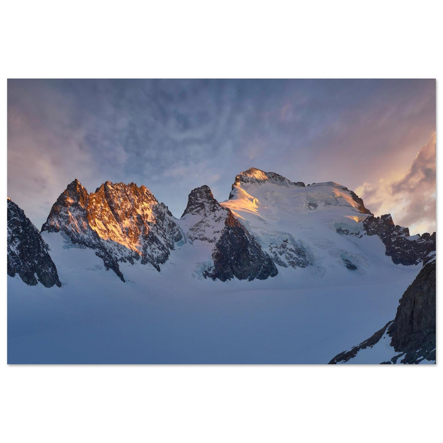
Gébroulaz reads as a vast high-mountain surface beneath the Dôme de Polset and the Aiguille de Péclet. It is less immediately spectacular than Bossons–Taconnaz or Grand Méan, but offers a broader, colder and more austere scene.
A sunrise photograph clearly shows this relationship between glacier and high relief: low light brings out volume and the transitions between rock, snow and ice.
Vanoise National Park monitors its evolution. Any figures on the glacier’s condition or retreat must therefore carry a date. The article can explain that the landscape is changing without turning a one-off measurement into a permanent truth.
Gébroulaz is less suited to seeking proximity: many observation points remain distant, and mountain difficulty varies greatly with the chosen area.

A broad glacial scene in the Vanoise
Low light separates the glacier, the Dôme de Polset and the Aiguille de Péclet without reducing the scene to a detail of ice.
Photograph: Pierre Thiaville
View the Gébroulaz glacier in the Vanoise photo printPhotography guide to the Vanoise massif.
Girose glacier — ice and verticality beneath La Meije
Choose the Girose for its relationship with La Meije and the very rocky world of La Grave. The scene differs from the Géant glacier: both belong to very high altitude, but La Meije’s rocky verticality gives this one a darker, more contrasting character.
The Col des Ruillans area offers access to these high mountains when the relevant facilities are operating. As access arrangements change, information here should be limited to what genuinely helps with the choice.
The main trap is confusing the Girose with a more general view of La Meije. For a clear reading, the ice itself must remain identifiable, not merely the massif’s silhouette.
Photographing La Meije in the Écrins.
Les Rouies glacial area — breadth and human scale
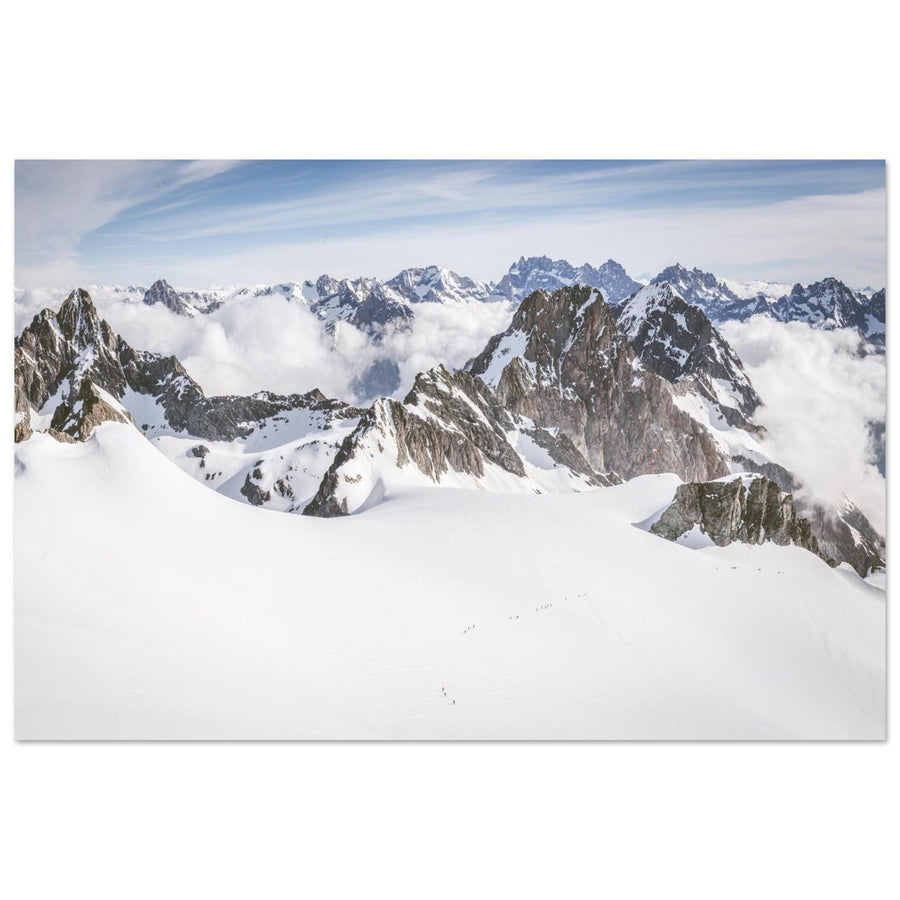
Les Rouies is selected as a glacial area or plateau because the scene rests on a sense of breadth. In Valgaudemar, great glacial surfaces and human figures provide a scale less apparent in a glacier photographed from very far away.
Roped parties can become tiny references within the image. What a photograph shows must be separated from what the article advises: a figure on the ice indicates scale, not a recommended route.
To understand the area without venturing onto the ice, ground-based views from Valgaudemar and the Gioberney area offer an introduction to the broader landscape. Reaching the glacier itself requires a different level of commitment.
Les Rouies is more relevant than Gébroulaz if human scale should form part of the image; Gébroulaz makes more sense if you seek a great glacial mass read within the landscape.

Human figures provide scale
Roped parties become tiny references within an expanse of ice that would otherwise be almost abstract.
Photograph: Pierre Thiaville
View the Les Rouies glacial plateau photo printPhotographing Valgaudemar in the Écrins.
3. Three scenes that change our intuitive idea of a glacier
These three cases remind us that a photographically interesting glacier is not necessarily a great wild tongue of ice: human development, a proglacial lake or debris cover can become the key to reading it.
Grande Motte glacier — when development is part of the landscape
The Grande Motte is interesting because its dome, changes in slope and developed surroundings offer a very different reading from a completely wild glacier. Glacier, summit, lifts and traces of high-altitude development coexist.
If your intention is to photograph the relationship between glacier and resort, this large-scale human presence becomes a fact of the landscape rather than a flaw to conceal systematically. Depending on the season and operation, snow, pistes and infrastructure strongly change how it reads.
This infrastructure is also its limitation: the Grande Motte is less suitable if you seek the impression of a glacier isolated from all development. Skiing quality, commercial snow conditions, lift passes and the ski area are not covered here.

The glacier within a developed high-mountain landscape
From Bellevarde, glacier, summit and traces of development can be read within the same scene.
Photograph: Obatala-photography
View the Grande Motte glacier photo printGrand Méan glacier — where ice meets the lake
Grand Méan stands out for its relationship with a proglacial lake, which is difficult to replace within this selection. The ice front appears as a cliff above the water; blocks of ice can break off and float in the lake.
Two precautions matter. The presence or number of floating blocks must never be promised for every visit. Nor can the place be reduced to this spectacular image: official Bonneval-sur-Arc documentation describes a demanding high-altitude hike and notes an unmarked final section. This level of information is enough for comparison here.
An overcast sky can retain detail in the ice and water; lower light emphasises the relief of the front. The lake remains exposed to wind, and no perfect reflection is guaranteed.
Grand Méan’s uniqueness comes precisely from the relationship between glacier front and lake; without it, we lose what distinguishes it from the other glaciers in this selection.
Photographing the Cirque des Évettes in the Vanoise.
Glacier Noir — when a glacier becomes almost entirely rocky
Glacier Noir breaks the mental image of a white glacier. A substantial part of its surface is covered in rocky material. The ice is read through moraines, landforms and breaks in the terrain rather than a broad pale surface.
Compared with Glacier Blanc, it shows how two neighbouring glaciers can tell radically different landscape stories. Glaciological context becomes useful because it directly informs the photographic decision: are you seeking the obvious presence of ice, or a scene whose glacial history is read mainly through rock?
Two limitations must be accepted. Glacier Noir may seem less immediately spectacular to someone expecting blue seracs or a great white tongue. And, as with Glacier Blanc, access from the Pré de Madame Carle area is particularly changeable in September 2026 following recent floods.
For Glacier Noir, I rely here on Écrins National Park documentation rather than an AAM field account.
How should you choose between the twelve glaciers?
The choice depends less on the glacier’s fame than on what you want in the image.
A great valley
Mer de Glace.
Seracs and verticality
Bossons–Taconnaz area.
A broad basin
Argentière.
Very high altitude
Géant glacier.
A wild cirque
Talèfre.
Glacier + resort
Grande Motte.
A broad Vanoise scene
Ice + La Meije
Exposed ice
Glacier Blanc.
Breadth + human scale
Ice front + lake
Grand Méan.
Debris and moraines
Glacier Noir.
These recommendations are conditional. They do not say that the Mer de Glace is “more beautiful” than Argentière or that Grand Méan is superior to Glacier Blanc. Each place better serves a different intention.
Season and light: what really changes the reading
Season matters because it can conceal or reveal forms, not because there is one perfect month for every glacier. Fresh snow can simplify the landscape but erase moraines, debris or some crevasses. Conversely, a less snowy period can better reveal the structure of a glacier tongue or Glacier Noir’s rocky cover.
Low light generally brings out relief, striations and seracs more clearly. Diffuse light may be preferable when retaining detail in very bright areas and in rock. Backlighting adds depth and silhouettes but can reduce the clarity of textures. These principles help you choose an atmosphere; detailed settings belong in the Photography Techniques guides.
None of these reference points should become a promise. Glaciers evolve, lakes change, snow varies and mountain conditions can transform a scene within hours.
After choosing a glacier
Once the scene is chosen, this page is not intended to do everything. To prepare a specific place, move to the photography destination guides; for light, exposure, snow or composition, use the Photography Techniques guides; for access, lifts, restrictions and glacial change, official or scientific sources remain the priority.
Key takeaways
There is no universally “most beautiful” glacier in the French Alps. There are scenes better suited to particular images: the depth of the Mer de Glace, the seracs of Bossons–Taconnaz, the breadth of Argentière, the very high world of the Géant, the Talèfre cirque, the developed Grande Motte glacier, the Vanoise of Gébroulaz, the verticality of the Girose, the exposed ice of Glacier Blanc, the expanse of Les Rouies, Grand Méan’s ice-front-and-lake relationship and Glacier Noir’s debris-covered character.
The right selection helps you choose without erasing the limitations: access, altitude, infrastructure, conditions and glacial change are as much part of the decision as the scene’s beauty.
Official sources and reference documents
Access, facilities, conditions and glaciers change. For current practical and scientific information, consult the sources below before departure.
- Chamonix Mont-Blanc — the valley’s glaciers
- Aiguille du Midi — Mont-Blanc Natural Resort
- Tignes — Grande Motte glacier
- Vanoise National Park — Gébroulaz glacier monitoring
- La Grave — Girose glacier / Col des Ruillans
- Écrins National Park — Glacier Blanc
- Écrins National Park — Glacier Noir
- Écrins National Park — access conditions after the floods
- Bonneval-sur-Arc — Grand Méan glacier
- Bonneval-sur-Arc — Grand Méan route via Les Évettes
- Écrins National Park — Les Rouies