The most beautiful high-altitude refuges in the French Alps
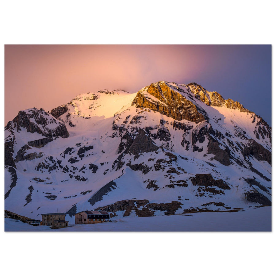
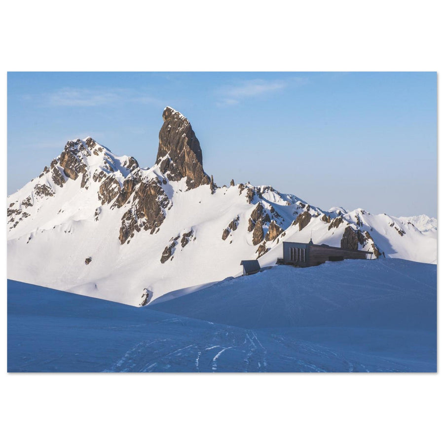
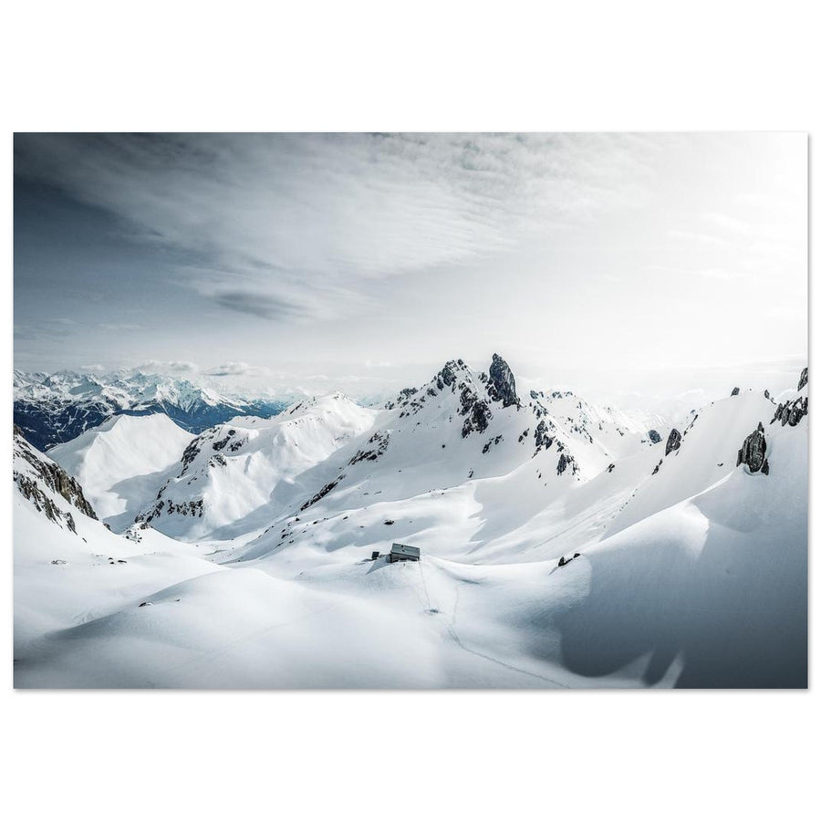
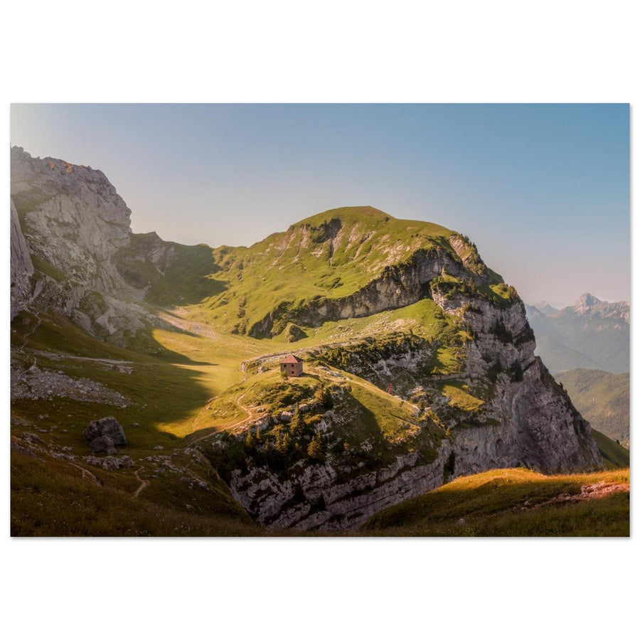
A mountain hut immediately changes how we read a mountain landscape. Without it, we see a rock face, a glacier, an Alpine pasture or a lake. With it, the image gains a human scale: a few windows beneath a great face, a small structure among limestone pavements, an isolated building beside a lake or a cabin almost lost in the ice.
This selection brings together eleven huts in the French Alps that I have chosen for different visual reasons. It does not aim to establish a universal “top 11”. Plan du Lac has almost nothing in common with the Aigle hut; Presset plays a different role from Furfande; the Valette is not a snowy version of the Couvercle. The point of the comparison is precisely to understand those differences and choose a scene that suits your project.
The order is therefore not a ranking from most to least beautiful. The selection moves from open, relatively accessible landscapes to more distinctive architecture, then to high-mountain huts where the level of commitment becomes a major part of the decision.
The eleven huts suit different visual intentions.
Each profile explains what it does best and what it asks in return.
The level of commitment helps you choose; route descriptions belong elsewhere.
The catalogue illustrates the selection but never determines which huts are included.
Which hut to choose at a glance?
| Hut | Why choose it | Dominant scene type | Commitment to be aware of | Light / time on location | Main trade-off |
|---|---|---|---|---|---|
| Plan du Lac | A broad Vanoise landscape that fits easily into a day | Alpine pastures, hut as a scale reference, summits | Low to moderate, depending on conditions | Very rewarding late in the day; an overnight stay is not essential | Less spectacular architecture than other huts |
| Furfande | A bright pastoral atmosphere with a more southern feel | Open pastures, dry mountain forms, space | Approachable to moderate | Golden hour suits it particularly well; a day visit is possible | The hut is less iconic than the surrounding landscape |
| Moëde-Anterne | A complete balcony between pastures, the Fiz and Mont-Blanc | Pastoral panorama, sunset, blue hour, night | High-altitude hike | The first and last light greatly strengthen the scene | Less dramatic than glacier huts |
| Vallonpierre | A hut, small lake and great summit in a single scene | Water, possible reflection, Sirac, stone-and-wood architecture | Intermediate | A day visit is possible; low-angle light helps | A gentler scene, more dependent on the accessible season |
| Col de la Vanoise | Understated architecture beneath an instantly recognisable summit | Hut + Grande Casse + rocky plateau | High-altitude hike | Strong late-day light; an overnight stay is not essential | Effort and visitor numbers |
| Presset | A striking graphic combination of architecture, lake and Pierra Menta | Strong shapes, lake, iconic summit | High-altitude hike | Sunrise and sunset are very rewarding | High-altitude access; a very recognisable scene |
| Pointe Percée–Gramusset | Distinctive contemporary architecture in a limestone-pavement setting | Rock, building lines, Pointe Percée | High-altitude hike; much more demanding depending on the season | Low-angle light is ideal for revealing the relief | Conditions and access quickly become decisive |
| Valette | A highly graphic rhythm when snow simplifies the landscape | Repeated forms, snow, minimalism | High-altitude hike | Sunrise, blue hour and time on location are particularly rewarding | Seasonality and access |
| Robert Blanc | A small isolated building facing a world of rock and ice | Isolation, glaciers, high mountains | Demanding | Sunrise and an overnight stay greatly enrich the experience | Isolation and commitment |
| Couvercle | A broad balcony over Talèfre and the Grandes Jorasses | Talèfre, Grandes Jorasses, glacial depth | High | Low-angle light and time on location are particularly powerful | Demanding access and conditions to check |
| Aigle | A perched hut in the world of La Meije, deep in the high mountains | Rock, snow, glacier, heritage, very high mountains | Mountaineering | Being there is part of the experience | Technical demands: this is not a standard photography hike |
This table does not replace official access information. It simply helps rule out options that do not suit your project and highlights those worth exploring further.
Which hut to choose for your type of image?
Wide panorama
If your main aim is a wide panorama without the building dominating, Plan du Lac is the simplest choice. Moëde-Anterne offers greater depth with Mont-Blanc in the background, while the Couvercle takes this approach to its extreme in a much more demanding glacial setting.
Pastoral atmosphere
For a pastoral atmosphere, Furfande stands apart: the hut is almost a reference point in the pasture rather than an architectural subject. Moëde-Anterne has a more spectacular backdrop; Plan du Lac is more accessible; Furfande retains a gentleness and colour palette particular to the Queyras.
Water in the composition
If you want water in the composition, Vallonpierre and Presset stand out. Vallonpierre is gentler, with a more even balance between hut, lake and Sirac. Presset is more graphic: the Pierra Menta and contemporary architecture create an instantly recognisable visual tension.
Architecture
For architecture, four huts tell different stories. La Valette works through repeated small structures, particularly striking beneath snow. Pointe Percée–Gramusset asserts its contemporary architecture amid limestone pavements. Presset plays on the encounter between building, water and Pierra Menta. The Aigle stands apart: its appeal lies as much in its seemingly impossible location as in its history and relationship with La Meije.
Glaciated high mountains
If glaciated high mountains are your main subject, Robert Blanc, the Couvercle and the Aigle form a clear progression. Robert Blanc remains legible as a small isolated hut among rock and ice. The Couvercle offers immense glacial depth. The Aigle goes further still in commitment and must never be presented as a simple hiking destination.
Recognisable summit
Finally, if you want an instantly recognisable summit in the image, the Col de la Vanoise facing the Grande Casse and Presset facing the Pierra Menta are the two most obvious choices. The first is broader and rockier; the second more graphic and concentrated.
Why these eleven huts?
I did not choose the huts for their comfort, capacity or reputation, or because an AluArtMountains artwork was available. Inclusion in the catalogue may show that a place has been photographed, but it never makes it eligible for the selection.
Each hut had to offer a real difference: architecture, a setting, mountain forms, a lake, a glacier, a pasture, light or a sense of scale not already provided by the others. Avoiding repetition matters: a long list of “beautiful” but visually interchangeable huts is less useful than a tighter selection in which each entry answers a distinct wish.
Provenance matters too. Several huts in this selection are documented by existing AAM photographs and content. Pointe Percée–Gramusset, Vallonpierre and the Aigle are included on the basis of documentary and visual sources; I therefore claim no unproven first-hand experience of them.
Finally, each hut must come with a trade-off. An easily accessible place may have less spectacular architecture. A spectacular hut may require substantial logistics. A scene that is perfect at sunrise can lose some of its appeal if being there at that hour is not realistic. Comparing only strengths would make a brochure; comparing limitations too helps you choose.
Visual signature
The hut must offer genuinely recognisable architecture, relief, light or a relationship of scale.
No repetition
Two huts with similar surroundings are both retained only if they lead to different photographic choices.
Honest provenance
First-hand experience and external documentation are distinguished, without blending them into a single collective voice.
Explicit trade-off
A useful comparison also explains why a hut may be less suited to your project.
Before setting off: what to check
1. For wide landscapes and Alpine pastures
In this first group, the building does not seek to dominate the image. Its main role is to provide scale, a focal point or a human presence in a larger landscape. Choose this group if you enjoy spacious compositions, pastures, panoramas or gentle relationships between architecture and relief.
Plan du Lac — for a broad Vanoise landscape without disproportionate logistics
Plan du Lac is the hut I recommend when the reader wants a landscape first, rather than spectacular architecture. In the pastures of Haute-Maurienne, the building readily becomes a foreground or scale reference, with summits creating depth behind it.
Its true comparative strength is accessibility. In this selection, it is one of the easiest huts for understanding the idea of a “hut in the landscape” without a long high-mountain approach. That does not mean conditions are always simple or access guaranteed: it means that, under comparable conditions, the effort required is not what defines the experience.
Late-day light separates pasture, building and mountain forms well. Unlike Robert Blanc or the Aigle, however, Plan du Lac remains rewarding without an overnight stay: the landscape already has its own volumes and depth.
Between the two, Plan du Lac is better if you want a more monumental, immediately legible Vanoise setting; Furfande suits a gentler, more southern atmosphere. If the hut's architecture should be the main subject, Presset or Pointe Percée are better candidates.
That is also its limitation: the building is less distinctive than other huts in the selection. If your image rests mainly on architecture, Plan du Lac is not the best choice.

The hut as a scale reference in the pastures
The building remains a human reference in the broad Vanoise landscape without overwhelming the mountains.
Photography: Pierre Thiaville
View the photo print of the Plan du Lac hutFurfande — for the light, space and gentleness of the Queyras
Furfande offers a sense of space found at few other huts. The landscape is open, pastoral and drier, with less imposing relief than in Mont-Blanc or the Écrins. The hut becomes a marker in the pasture rather than a small building wedged beneath a rock face.
That is precisely what sets it apart from Moëde-Anterne. Both have a pastoral character, but Moëde places more emphasis on the panorama facing Mont-Blanc. Furfande is more horizontal, brighter, and more dependent on the texture of the slopes and quality of light.
Low light brings out the undulations of the pasture and helps separate the layers. It nevertheless remains a coherent day-trip objective when conditions and official access allow: the scene's value does not depend exclusively on experiencing sunrise from the hut.
Furfande makes the most sense when the hut should remain part of an open landscape rather than become a monument. For an iconic summit or instantly recognisable architecture, Presset, the Col de la Vanoise or Pointe Percée offer a stronger image.
Furfande's limitation is clear: its appeal lies more in the landscape than in the building itself. The relationship between hut and pasture should therefore guide the choice more than the building's architectural distinctiveness.
Moëde-Anterne — to connect pastures, the Fiz and Mont-Blanc
Moëde-Anterne offers one of the selection's most complete compositions: a hut in a still-green landscape, the Fiz mountains and a backdrop opening towards the Mont-Blanc massif.
Compared with Furfande, the scene has more layers of depth. Compared with Plan du Lac, the background is more spectacular. And compared with the Couvercle, it remains a pastoral world where the hut feels welcoming and close, rather than an almost exclusively rocky and glacial environment.
Late-day light, blue hour and night can give the hut added presence, especially when windows or sky create a transition between natural landscape and human presence. The technical guides then take over for settings and shooting method.
Moëde-Anterne is more relevant if you want an inhabited, distinctly Alpine panorama without entering the glaciated high mountains directly. For a tighter, more graphic composition, Presset is stronger; for a more minimalist approach, the Valette goes further.
In return, the building itself is less spectacular than Pointe Percée or the Aigle. Here again, the strength comes from the relationship between several layers.

An inhabited balcony facing Mont-Blanc
The hut connects the pastures, the Fiz and the Mont-Blanc massif in a layered composition.
Photography: Pierre Thiaville
View the photo print of the Moëde-Anterne hutVallonpierre — to combine a hut, a small lake and the Sirac
Vallonpierre brings a combination missing from the previous article: a stone-and-wood hut, a small lake and a great mountain face with the Sirac. Where Presset produces a highly graphic image, Vallonpierre offers a gentler, more balanced scene in which water can become a second subject.
It most clearly combines “hut + lake + great summit” without seeking Presset's more architectural aesthetic. The water allows reflections when conditions suit, but the hut should never be promoted as a guarantee of a perfect mirror: wind, light and water level remain conditions, not properties of the place.
In terms of choosing, Vallonpierre lies between the most accessible huts and high-mountain huts. It can be considered as a day outing depending on conditions and official access; information from the Écrins National Park remains the reference for planning the route.
Compared with Plan du Lac, Vallonpierre becomes the more coherent choice as soon as water belongs in the image you seek. Presset better suits a stronger encounter between architecture and summit; Robert Blanc or the Couvercle become more appropriate when you want to leave pastoral scenery entirely for a glacial world.
The trade-off lies in the scene's very gentleness: it may feel less spectacular if you seek radical architecture or a stark, rocky high-mountain setting.
2. For architecture and relief
Here, the hut does more than provide scale. Its shape, setting or the mountains it responds to becomes an essential part of the composition. These are the best choices if you want the building to be recognisable and the landscape to be more specific than “any hut in the Alps”.
Col de la Vanoise — for the Grande Casse and the scale of the rocky plateau
The Col de la Vanoise hut works because three elements respond to one another: an understated building, a broad high-mountain plateau and the Grande Casse. The hut immediately establishes the scale of the face without becoming too dominant.
Compared with Presset, the Col de la Vanoise is less graphic but more expansive. Compared with Plan du Lac, it retains the hut-as-scale-reference idea in a rockier, more demanding setting. Compared with the Aigle, it remains a hut that can fit a high-altitude hiking project rather than a mountaineering objective.
Late-day light particularly suits this scene when the Grande Casse receives warmer light and the plateau starts to cool. This view is already documented in AAM photographs; it need not be turned into an exposure recipe.
The Col de la Vanoise is especially relevant if your priority is an instantly recognisable summit and a wide composition. For strong contemporary architecture, Pointe Percée or Presset are more interesting. For a glacial atmosphere, the Couvercle and Robert Blanc go much further.
Two limitations matter: effort and visitor numbers can affect the experience. To plan the route, continue with the Grande Casse photography guide or the official source rather than overloading this comparison.

The Grande Casse sets the scale
The hut remains legible without dominating the rocky plateau or the Grande Casse.
Photography: Pierre Thiaville
View the photo print of the Col de la Vanoise hutPresset — for the Pierra Menta, the lake and clear geometry
Presset has an immediately graphic signature. The vertical Pierra Menta responds to the hut's more horizontal lines, and the lake can add another layer between architecture and relief.
It is more concentrated than the Col de la Vanoise. The Vanoise landscape impresses through scale; Presset through the relationship between a few strong shapes. That also distinguishes it from Vallonpierre: both combine hut, water and mountain, but Vallonpierre is more pastoral and balanced, Presset more architectural and iconic.
Low-angle light is often enough to reveal these shapes without requiring a spectacular sky. The first and last light become more valuable if you are already there, making an overnight stay or suitable planning relevant to the project — without making it an editorial requirement.
Presset is especially suited to an instantly recognisable image and a clear dialogue between architecture and summit. Vallonpierre offers something gentler, the Valette a more minimalist graphic character, and Pointe Percée more contemporary architecture in a rocky setting.
Its limitation lies more in its instantly recognisable character and high-altitude approach. The hut–Pierra Menta relationship quickly produces a familiar image: a clear intention for light, season or framing then matters more than simply reproducing the obvious viewpoint.

Architecture and Pierra Menta
The vertical Pierra Menta responds to the hut's simple lines and concentrates the image.
Photography: Pierre Thiaville
View the photo print of the Presset hutPointe Percée–Gramusset — for contemporary architecture among limestone pavements
The Pointe Percée–Gramusset hut brings a distinct visual language to this selection. Here, contemporary architecture does more than blend into the terrain: it engages with the limestone pavements and very rocky relief of the Aravis.
Compared with Presset, the lake disappears and rock texture takes over. Compared with the Valette, the graphic quality comes from a more assertive building rather than repeated small structures. Compared with the Aigle, the architecture remains contemporary and accessible within a high-altitude hiking context, whereas the Aigle clearly belongs to mountaineering.
Choose Pointe Percée–Gramusset if your image should speak as much about architecture as mountains. Low-angle light can be especially effective at revealing the limestone relief and the building's volumes, but this recommendation remains a source-based reading of the site, not an AAM first-hand account.
Seasonal conditions matter enormously. The same hut does not demand the same commitment on dry ground as in winter conditions. For choosing, remember above all that access and season are real decision factors; check route details with the hut.
The real limitation is dependence on conditions and access. A photograph showing only the building tells less about the site than a view that retains the limestone pavements and the surrounding relief.

Contemporary architecture among limestone pavements
The vertical frame focuses attention on the building, while the card retains the limestone pavements and relief as context.
Photography: theoballet
View the photo print of the Pointe Percée hutLa Valette — for minimalism, snow and the rhythm of buildings
The Valette is different because it does not read as a single hut. The group of small buildings creates repetition that becomes especially powerful when snow simplifies the terrain and erases some details.
The approach here is deliberately minimalist. Presset is graphic through the Pierra Menta; Pointe Percée through architecture and limestone pavements; the Valette through repetition, shadows and volumes.
Sunrise is documented in existing AAM images and strengthens this effect, particularly when parts of the terrain remain cool while the sky or mountains begin to catch the light. Being on location therefore has more value here than at Plan du Lac if that transition is your precise objective.
The Valette stands out when snow, geometry and simplicity matter more than a monumental panorama. Prefer Moëde-Anterne for multiple layers and a Mont-Blanc backdrop; Presset for an iconic summit; the Aigle for isolated architecture in an extreme glacial world.
Its limitation lies in the seasonality of its strongest visual language. The hut should not be reduced to snow, but its graphic identity is clearest when conditions simplify the scene.

Repetition, snow and minimalism
The repetition of buildings becomes particularly clear when snow simplifies the terrain.
Photography: Pierre Thiaville
View the photo print of the Valette huts3. For glaciated high mountains
In this group, the landscape changes scale, and the commitment changes with it. The hut becomes a human trace in a world dominated by rock, snow and ice. These three sites must never be treated as equivalent to Plan du Lac or Furfande in terms of terrain.
Robert Blanc — for solitude at the foot of the Aiguille des Glaciers
Robert Blanc is particularly effective for showing a small isolated building in surroundings where vegetation almost disappears. Rock, snow and glaciers dominate; the hut measures the scale of the massif.
Compared with the Couvercle, Robert Blanc is more intimate and more focused on the building's isolation. The Couvercle opens a wider glacial panorama. Compared with the Aigle, Robert Blanc remains less extreme in both architecture and technical demands.
Sunrise is already documented in AAM content and suits this approach: the still-cool areas around the hut reinforce the feeling of a night spent at altitude while light gradually returns to the mountains.
Robert Blanc is more relevant if you seek isolation and the relationship between small architecture and great mountains. The Couvercle has the advantage when glacial depth should dominate; the Aigle goes further still if you are prepared for terrain reserved for mountaineers.
In return, the commitment becomes a real limitation. Its photographic value benefits greatly from time on location, but that must never be taken as an invitation to set out without appropriate preparation.

A tiny hut among rock and ice
The building's small size makes the scale of the massif immediately apparent.
Photography: Pierre Thiaville
View the photo print of the Robert Blanc hutCouvercle — for a true balcony over the glacial world
The Couvercle hut stands out less for its architecture than for its position. The Talèfre glacier, the Grandes Jorasses and the needles of the Mer de Glace basin create a depth few other huts in the comparison can offer.
Compared with Robert Blanc, the landscape takes more of the lead. Compared with the Aigle, the scene focuses less on the cabin itself and more on the panorama. It becomes especially relevant when your priority is a hut providing scale within an immense glacial setting.
Low-angle light naturally strengthens the volumes of glaciers and needles, but conditions and access must be checked with the official source. Bivouac and access rules can change quickly: always check the hut's current information before planning the outing.
If landscape depth drives your intention, the Couvercle becomes the natural choice; if building isolation matters most, Robert Blanc tells that story better. If perched architecture and La Meije should form the heart of the image, the Aigle takes you into another realm.
The trade-off is clear: access is demanding, and the high mountains must not be reduced to an aesthetic selling point.

A balcony over Talèfre
The hut becomes a scale reference facing the Talèfre glacier and the great summits.
Photography: Pierre Thiaville
View the photo print of the Couvercle hutAigle hut — for the selection's most dramatic image
At 3,440 metres, perched on the Rocher de l'Aigle near La Meije, the Aigle hut occupies a special place in this comparison. It is not simply “a beautiful hut higher than the others”: its position, history and the preservation of part of its historic structure give it an identity of its own.
Visually, it combines three things rarely found together elsewhere: the sense of a hut placed somewhere almost impossible, a world of snow and glacier, and historic architecture that remains legible in the high mountains.
Compared with the Couvercle, the Aigle is more the subject itself. Compared with Robert Blanc, its position and commitment are more extreme. Compared with Pointe Percée, it shares the idea of strong architecture among rock, but moves into an entirely different environment requiring different mountain skills.
The Aigle is relevant if you seek a very high-mountain scene and understand that the image cannot be separated from the terrain's demands. The Aigle requires mountaineering: presenting it as an accessible photography outing would be misleading.
Its main limitation is also its strength. The technical demands mean it is not a realistic choice for many readers. In an honest comparison, that information matters as much as its visual power.
How to decide between the eleven huts?
If you are still unsure, the right question is not “which is the most beautiful?” but “what should dominate my image?”.
Wide landscape
For the hut simply providing scale in a wide landscape: Plan du Lac, Moëde-Anterne or Couvercle.
Architecture
For architecture: Valette, Pointe Percée–Gramusset, Presset or Aigle.
Water
For water: Vallonpierre and Presset.
Recognisable summit
For an instantly recognisable summit: Col de la Vanoise and Presset.
Pastoral landscape
For a pastoral landscape: Furfande, Moëde-Anterne and Plan du Lac.
Glacial world
For a glacial world: Robert Blanc, Couvercle and Aigle.
After choosing: prepare your outing
A selection like this answers “which one should I choose?”. It should not take on every question that follows.
For detailed preparation of an area or site, use the destination guides where available. For light, exposure, snow, sunrise, sunset and composition, the technical guides explain the “how”. For staffing, access, local rules, bivouacs, bookings and current conditions, the official hut source, FFCAM, national park or managing body remains the authority.
AAM artworks and the hut collection can extend the article if you want to see the exact photographs presented, but they never determine the selection.
Key points
There is no universally most beautiful hut in the French Alps. There are huts better suited to particular images.
Plan du Lac is more relevant than the Aigle if you want an accessible wide landscape. The Aigle is incomparable if your subject is a cabin perched in a very high-mountain world. Presset is more graphic than Vallonpierre; Vallonpierre is gentler and more closely tied to water. The Valette is more minimalist than Moëde-Anterne; Moëde offers greater depth. Robert Blanc tells the story of isolation better; the Couvercle better conveys glacial immensity.
These are the differences that should guide your choice. Beauty is not a score: it is the meeting of a scene, light, a level of commitment and what you truly want to show.
Official information for planning your outing
Access, staffed periods, bookings and local rules may change. For up-to-date practical information, consult the official pages below directly.
- Col de la Vanoise hut — FFCAM
- Valette hut — Vanoise National Park
- Plan du Lac hut — Vanoise National Park
- Robert Blanc hut
- Presset hut — FFCAM
- Moëde-Anterne hut — Passy Tourist Office
- Furfande hut
- Couvercle hut — FFCAM
- Pointe Percée–Gramusset hut — FFCAM
- Vallonpierre hut — Écrins National Park
- Aigle hut — FFCAM