Où photographier le Beaufortain ? Lacs, alpages et Pierra Menta - AluArtMountains

Where to photograph the Beaufortain? Lakes, alpine pastures and Pierra Menta

Published July 30, 2026

The Beaufortain possesses a photographic identity very different from the large neighboring glacial massifs. Here, lakes, dams, alpine pastures, and mineral landscapes interact in a still heavily inhabited and pastoral setting. Lake Roselend offers vast perspectives from the Col du Pré and Roche Parstire. Saint-Guérin provides more graphic compositions around the reservoir and dam. Higher up, Lake Presset, its refuge, and the Pierra Menta form a more mineral, isolated, and demanding backdrop.

This diversity allows for the creation of a complete series without repeating the same image. One day can be dedicated to the roads, alpine pastures, and panoramas of Roselend. Another can focus on the shapes of the Saint-Guérin dam. A night at the Presset refuge finally grants access to the first and last light facing the Pierra Menta.

This main guide helps choose the right area according to the desired image, season, light, and level of commitment. For practical details and field advice, it refers to our two in-depth guides: Roselend, Roche Parstire, and Saint-Guérin, then Presset, its refuge, and the Pierra Menta. It also complements the Photo Destinations in the Alps hub and the collection of Beaufortain photo prints.

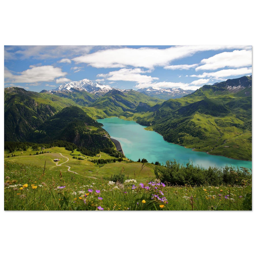
Panoramic photo print of Lake Roselend and Mont-Blanc from Roche Parstire in the Beaufortain
Roche Parstire overlooks Lake Roselend and offers a wide view of the Beaufortain. Photography by Christophe Cappelli. Discover this Roselend photo print.

The essentials in 30 seconds

  • Most iconic panorama: Lake Roselend from Roche Parstire or the heights of Col du Pré.
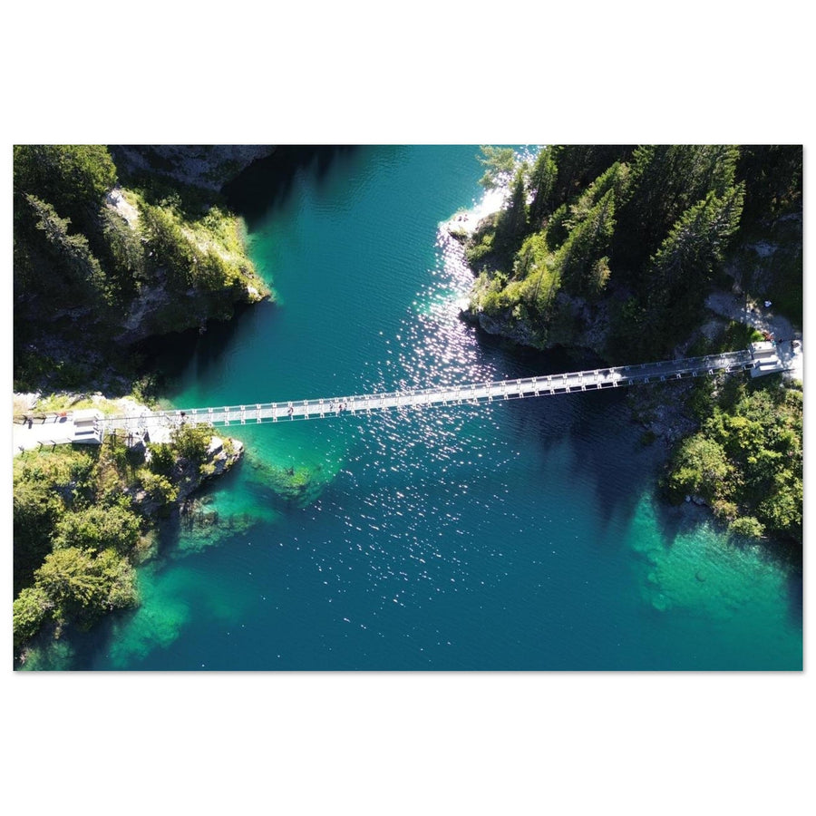
  • Most graphic area: Lake and dam of Saint-Guérin, with their lines, shores, and footbridge.
  • High mountain landscape: Lake and refuge of Presset facing the Pierra Menta.
  • Easiest season: Summer, when high-altitude roads and hiking trails are accessible.
  • Most interesting light: Morning or late afternoon to separate alpine pastures, lakes, and ridges.
  • Essential tip: Choose only one area per outing rather than going through Roselend, Saint-Guérin, and Presset without allowing time for the light to evolve.

Why is the Beaufortain a unique photographic area?

The Beaufortain is distinguished by the constant relationship between natural landscapes, pastoral activity, and hydraulic developments. Lakes Roselend and Saint-Guérin are not isolated bodies of water in a wild setting. They belong to valleys where roads, dams, alpine pastures, and herds remain visible. This human presence does not diminish the power of the landscape; it gives it scale and identity.

At Roselend, the space is very open. The curves of the reservoir extend into the meadows, roads, and ridges. From Roche Parstire, the view encompasses several levels of the massif, with the lake below and distant peaks that can include the Pierra Menta or Mont-Blanc depending on the angle and visibility.

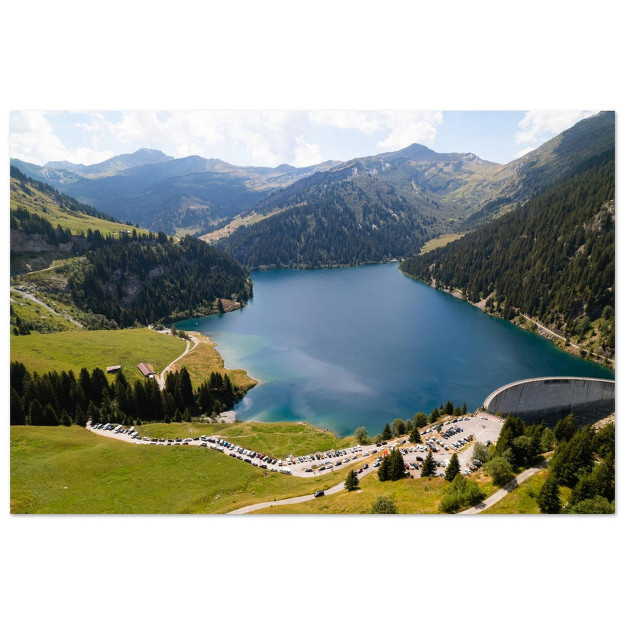
Saint-Guérin offers a more compact interpretation. The dam and footbridge form strong graphic lines, while the nearby slopes further enclose the landscape. The location works well for tight compositions, plunging views, and details of the shores.

Presset changes register completely. The lake is smaller, the environment more mineral, and access requires a hike. The refuge and the Pierra Menta immediately give a hierarchy to the scene. The landscape appears more isolated, especially at blue hour, sunrise, or under snow.

This succession of environments allows for the production of a very rich series: pastoral panorama, dam architecture, lacustrine landscape, high mountain refuge, isolated summit, and winter scene. The coherence comes from the massif, but each sector retains its own visual language.

Which area to choose according to the desired image?

Area Main subjects Atmosphere Access level Useful focal lengths
Roche Parstire and Col du Pré Lake Roselend, alpine pastures, roads, Mont-Blanc and Pierra Menta Panoramic and pastoral Road then ridge hike 24–70 mm, 70–200 mm
Roselend and its shores Lake, dam, chapel, valleys and roads Open and monumental Several seasonal road accesses 35–135 mm
Saint-Guérin Dam, footbridge, lake, shores and aerial views Graphic and more intimate Access close to the dam then walk 24–120 mm
Presset Lake, refuge, Pierra Menta, snow and sunrise Mineral and isolated Strenuous hike, overnight stay at the refuge useful 24–70 mm, 70–200 mm

For a first discovery, Roselend remains the most versatile sector. It allows for quickly obtaining a strong view while varying the angles. Saint-Guérin is well suited for a half-day or a series focused on lines and shapes. Presset requires more preparation, but offers the most typical high mountain images.

1. Lake Roselend, Roche Parstire, and Col du Pré

Roselend is the most obvious photographic gateway to the Beaufortain. The lake occupies a vast basin surrounded by alpine pastures and relief. The roads of Col du Pré and Cormet de Roselend offer several vantage points, while Roche Parstire allows for enough distance to comprehend the whole.

From the ridge of Roche Parstire, avoid working exclusively with a very wide-angle lens. The landscape appears spectacular to the eye, but too short a focal length reduces the lake and peaks to small elements. A medium focal length or a telephoto lens allows for building simpler compositions around a shore, a layer of mountains, or an identifiable summit.

Col du Pré and neighboring roads provide interesting leading lines. A road curve can lead towards the lake or highlight the folds of the alpine pastures. However, it should never become a pretext for parking outside authorized areas or obstructing traffic.

Around the reservoir, the chapel, the dam, and the shores allow for varying the scales. The lake can be the main subject, but it can also become a colored surface connecting several planes. The lateral lights of morning or late afternoon are generally the most effective for separating the slopes.

The detailed guide brings together access, viewpoints, and composition strategies:

Panoramic photo print of the Roselend valley in the Beaufortain, Savoie
The Roselend valley shows the relationship between alpine pastures, roads, and the relief of the Beaufortain. Photography by Denis Belitsky. Discover this Roselend photo print.

2. Lake and dam of Saint-Guérin

Saint-Guérin offers a more confined alternative to Roselend. The dam, reservoir, shores, and footbridge create clear forms that are well suited to medium focal lengths. The location is less dependent on a distant panorama: even when the peaks are partially obscured, the lines of the site remain exploitable.

From the approaches to the dam, look for diagonals and curves that connect the structure to the landscape. Too frontal a view can make the image static. A slight offset or a higher point reveals more of the reservoir's geometry.

Aerial photographs particularly well illustrate this organization, but they should not obscure regulations. The exact zone, temporary restrictions, presence of people, and rules specific to structures must be verified before each flight.

On foot, a walk leads to the footbridge and several viewpoints along the lake. The first and last hours of the day often offer softer light and reduced attendance.

Aerial photo print of Lake and Dam of Saint-Guérin in the Beaufortain
Aerial view of the relationship between the dam, lake, and reliefs of the Beaufortain. Photography by SYLVAIN FELTEN. Discover this Saint-Guérin photo print.

3. Lake Presset, refuge, and Pierra Menta

Presset is the most challenging sector of the cluster. The classic access from Treicol requires a strenuous hike, and the best strategy for photographing sunset, blue hour, and sunrise often involves sleeping at the refuge.

On site, three elements structure most compositions: the lake, the refuge, and the Pierra Menta. The classic view works because these three planes are naturally hierarchical. To produce a more personal series, move around the lake, change the shooting height, and use medium or long focal lengths more.

The refuge gives a human scale to the landscape. With a telephoto lens, it can be visually brought closer to the monolith. The lake provides a dark or reflective surface, but a perfect reflection is neither guaranteed nor indispensable. Ripples, snow patches, and variations in light can be more interesting than an expected symmetry.

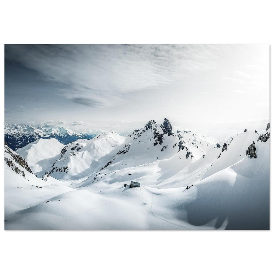
In winter, the landscape becomes more graphic and isolated, but access crosses avalanche-prone areas. This period requires specific preparation and skills; summer itineraries should not be reproduced without appropriate assessment.

The detailed guide covers access, overnight stays at the refuge, compositions, and seasonal conditions:

Photo print of the sunrise at Lake Presset facing the Pierra Menta in the Beaufortain
Lake Presset and the Pierra Menta form an immediately recognizable high mountain landscape. Photography by Bel Cassandra. Discover this Presset photo print.

4. Other areas to explore in the Beaufortain

The current catalog and cluster deliberately focus on Roselend, Saint-Guérin, and Presset. However, the massif offers other possibilities for future outings or guides.

Arêches and the inhabited valleys

Villages, hamlets, forests, and alpine pastures allow the Beaufortain to be portrayed as a living territory. These subjects are particularly interesting when snow highlights the architecture or when light passes through the slopes in autumn.

La Gittaz

The Gittaz dam and valley naturally extend the theme of water and hydraulic structures. This sector does not yet have sufficient product coverage to justify a standalone N4, but it could complement the cluster as the catalog expands.

Cormet de Roselend and the passes

High-altitude roads, curves, snowfields, and views of the valleys produce different images than the lakes. This sector is highly dependent on seasonal openings and weather conditions.

Le Grand Mont and the Arêches ridges

These reliefs allow for a more athletic and mineral interpretation of the massif. Again, the priority remains to consolidate subjects already well represented in the gallery before multiplying the pages.

Which season to choose?

Summer is the easiest time to combine all three major sectors. High-altitude roads are generally accessible according to their schedule, trails are easier to navigate, and the Presset refuge operates during its staffed periods.

Early autumn offers lower light, often reduced crowds, and softer colors in the alpine pastures. Days shorten quickly, and the first snowfalls can affect access.

Late spring allows for photographing the transition between snowfields and meadows, but roads and trails may still be partially snow-covered or wet. Each access must be checked rather than relying on an average date.

Winter transforms villages, refuges, and ridges. Roselend and Presset are then visited via different routes than in summer. The risks associated with snow and avalanches require specific preparation.

Sunrise, sunset, and weather

The Beaufortain region is particularly well-suited for side lighting. It highlights the folds of the alpine pastures, separates the layers of relief, and prevents lakes from becoming mere uniform surfaces.

Mornings often offer clearer air and less wind. They are well-suited for panoramas from Roche Parstire and reflections at Presset. Late afternoons warm the meadows and can isolate a ridge or a shore in more directional light.

Partially cloudy days are often more interesting than a perfectly blue sky. Breakthroughs of light create hierarchy and can illuminate part of the lake while keeping the relief in shadow.

The weather changes rapidly at altitude. Plan a lower or more accessible alternative when the ridges are obstructed. Saint-Guérin sometimes remains graphically usable even when the panoramas of Roselend or Presset are closed.

How to organize a photo trip?

One day

Devote it to Roselend and Roche Parstire, or to Saint-Guérin. Trying to combine all sectors reduces the time spent on light and increases travel.

Two days

The first day can be dedicated to Roselend and Saint-Guérin. The second allows you to climb to Presset and sleep at the refuge to work on sunset and sunrise.

Three days

Add a buffer day for weather or an exploration of the inhabited valleys around Arêches and Beaufort. This buffer is often more useful than an overly tight schedule.

In all cases, check the roads, trail conditions, and refuge arrangements before departure. Access to passes and high-altitude car parks is seasonal.

What equipment to bring?

  • 24–70 mm: primary lens for landscapes, lakes, roads, and refuges.
  • 70–200 mm: very useful for Pierra Menta, layers of relief, shores, and dam details.
  • Tripod: relevant at blue hour, sunrise, and for compositions around water.
  • Polarizing filter: to be used sparingly, especially on wide panoramas where its effect can become uneven.
  • Batteries and protection: essential for wind, cold, and nights in a refuge.

For landscapes, f/8 is a good starting point. Then adjust the aperture to the actual depth of the scene. On windy ridges, prioritize a sufficient shutter speed rather than a minimal ISO at all costs.

Roads, pastoralism, bivouac, dogs, and drones

The roads to Col du Pré, Cormet de Roselend, and high-altitude car parks are subject to seasonal closures. Consult official local information and Savoie Route before each trip.

Beaufortain is a pastoral area. Stay on marked trails, close gates, and maintain a significant distance from herds. Dogs must be kept on a leash in mountainous areas, and some restrictions may apply depending on the routes.

Bivouacking around the lakes and the Presset refuge is regulated. The rules are more precise than the general tolerance for bivouacking in the mountains. Check information directly with the refuge and local authorities before setting up camp.

Drones are subject to national, temporary, and local restrictions. Structures, wildlife, people, and herds add specific constraints. The presence of aerial photographs in the gallery does not mean that a flight is authorized today in the same location.

Safety comes before photography. On Roche Parstire, be attentive to wind and ridge crossings. In winter, consult the avalanche risk assessment bulletin and do not venture out without the appropriate skills.

Common mistakes to avoid

  • Systematically using an ultra-wide-angle and reducing the lakes or Pierra Menta to small elements.
  • Visiting too many locations without waiting for truly interesting light.
  • Presenting Beaufortain solely as a succession of dams, when alpine pastures and high mountains also shape the territory.
  • Seeking a perfect reflection at all costs instead of utilizing shoreline lines, clouds, or color variations.
  • Confusing summer road accessibility with permanent year-round access.
  • Too quickly creating new N4s in locations not yet extensively covered by the catalog.

Beaufortain photo prints

The gallery currently brings together several complementary landscapes: Lake Roselend from Roche Parstire, the Roselend valley, aerial views of Saint-Guérin, sunrise at Lake Presset, and two interpretations of the Pierra Menta with the refuge.

These photographs are offered in the Beaufortain photo prints collection, printed on matte Dibond aluminum and made to order.

Photo print of Pierra Menta and Presset refuge under snow in winter in the Beaufortain
In winter, the refuge becomes a discreet landmark in the snowy hollows dominated by Pierra Menta. Photography by Pierre Thiaville. Discover this winter photo print of the Beaufortain.

FAQ

What are the best places to photograph the Beaufortain?

The most complementary sectors are Lake Roselend and Roche Parstire, Lake Saint-Guérin, then Lake and Presset refuge facing the Pierra Menta.

Which sector to choose for a first outing?

Roselend is the most versatile. It offers panoramas, roads, alpine pastures, and several viewpoints without immediately requiring an overnight stay in a refuge.

Where to photograph Pierra Menta?

The Presset sector offers the strongest relationship between Pierra Menta, the lake, and the refuge. Roche Parstire also allows it to be integrated into a wider panorama.

What is the best season to photograph the Beaufortain?

Summer is the easiest time to access passes, lakes, and the Presset refuge. Early autumn offers lower light and often reduced crowds.

Can the Beaufortain be photographed without a long hike?

Yes. Roselend and Saint-Guérin have several accessible points from seasonal roads or with a short walk. Roche Parstire and Presset require more effort.

What focal length to use in the Beaufortain?

A 24–70 mm covers the majority of landscapes. A 70–200 mm is particularly useful for isolating peaks, bringing relief layers closer, and simplifying panoramas.

Should you sleep at the Presset refuge?

It's not mandatory to visit the site, but a night at the refuge greatly facilitates photographs of sunset, blue hour, and sunrise.

Are the Roselend roads open all year?

No. High-altitude roads and passes are subject to seasonal closures and weather conditions. Check their status before each outing.

Are dogs allowed in the Beaufortain?

Rules vary depending on the routes. Dogs must be kept on a leash in mountainous areas, and some areas or hikes may have additional restrictions.

Can a drone be used at Roselend, Saint-Guérin, or Presset?

There is no general authorization. The exact area, air restrictions, local rules, presence of people, structures, and wildlife protection must be checked before each flight.

Back to blog