Où photographier le Queyras ? Spots photo et conseils terrain - AluArtMountains

Where to photograph the Queyras? Photo spots and field tips

Published on July 30, 2026

Photographing the Queyras means transitioning over a short distance from an almost desert-like mineral landscape to a larch forest, from a high-altitude village to a mountain lake, then from a pass road to ridges opening towards Italy. This diversity gives the massif an immediately recognizable identity, but it also requires choosing one's sector carefully: a single day does not allow for adequately covering Izoard, Ceillac, Saint-Véran, and the Agnel pass.

This guide brings together the main sectors to build a coherent series: the Casse Déserte and the hairpin bends of the Izoard pass, the reflections of Lac Miroir, the cirque of Lac Sainte-Anne, the chalets of Saint-Véran, the Clausis chapel, the high pastures of the Col Agnel, and the silhouettes of the Pain de Sucre or Mont Viso. The objective is not to multiply locations, but to understand what light, season, and focal length are suitable for each landscape.

The Queyras naturally complements our guide to photo destinations in the Alps. The works already available are grouped in the collection of Queyras photo prints, printed on demand on matte Dibond aluminum.

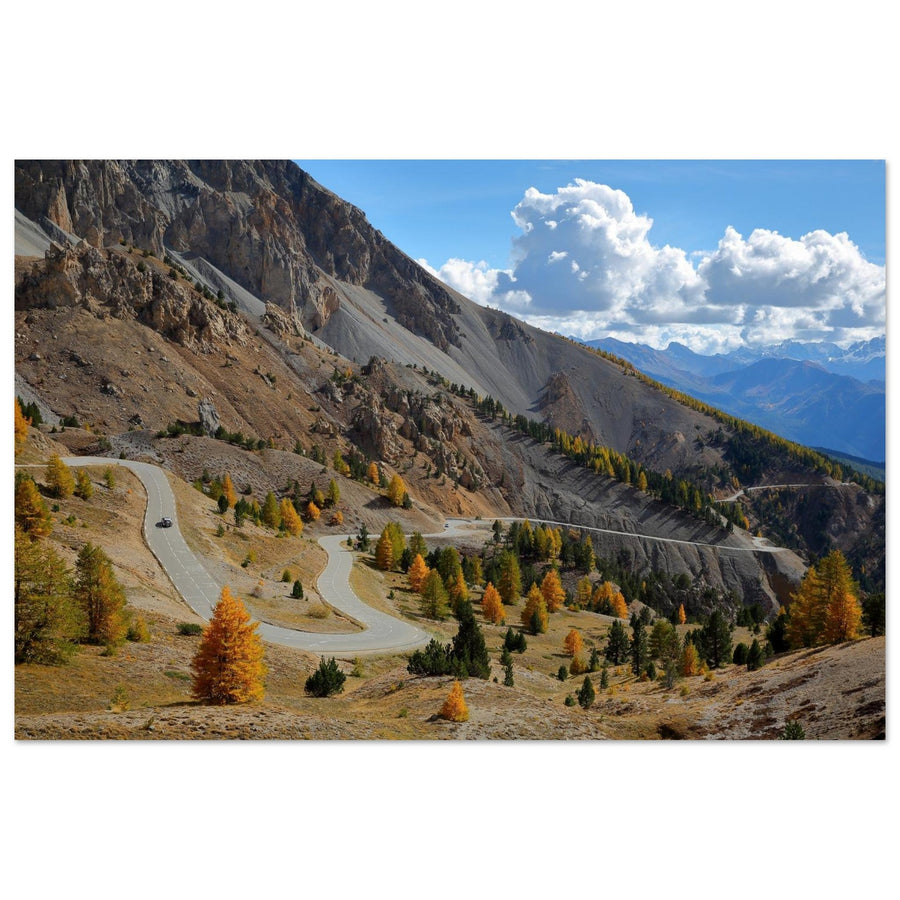
Photo print of the Casse Déserte at Col d'Izoard in the autumn colors of the Queyras
The Casse Déserte summarizes the mineral face of the Queyras, between rocky peaks, scree, and autumn larches. Photography by Christophe Cappelli. Discover this photo print of the Casse Déserte.

The essentials in 30 seconds

  • Most emblematic landscape: the Casse Déserte and the Col d'Izoard for their mineral lines and contrasts with the larches.
  • Best sector for lakes: Ceillac, with Lac Miroir in a vegetated setting, then Lac Sainte-Anne in a more rocky cirque.
  • Best sector for heritage: Saint-Véran and the Clausis chapel.
  • Best high mountain sector: Col Agnel, Agnel refuge and Pain de Sucre.
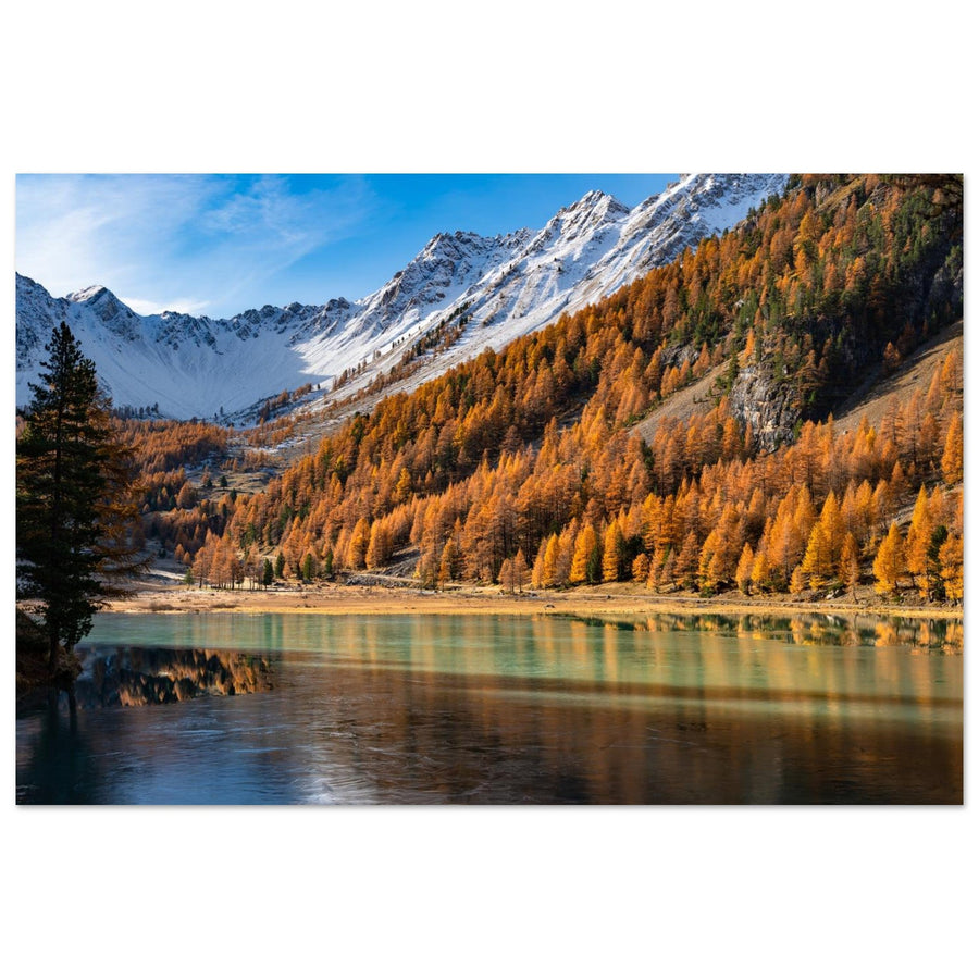
  • Most distinctive season: autumn, when golden larches meet grey rock and the first snows.
  • Most useful focal lengths: 24–70 mm for context; 70–200 mm for isolating ridges, illuminated trees and layers of relief.
  • Point of vigilance: high-altitude passes and roads are seasonal; weather, herds and local rules must be checked before each outing.

Why the Queyras is a unique photographic terrain

The Queyras is distinguished by the proximity of highly contrasted landscapes. On the Izoard slope, the rocky peaks and scree of the Casse Déserte produce dry, graphic, almost monochrome compositions. In Ceillac, the lakes, alpine pastures, and larches create softer images. Saint-Véran adds a human dimension with its chalets, narrow streets, and heritage. Higher up, the Col Agnel opens up a simple setting of ridges, alpine pastures, and high mountains.

This variety does not preclude the need to build an image. Well-known landscapes are often photographed too broadly, as if the name of the place were enough. In the Queyras, the strongest compositions generally rely on a clear relationship: a road crossing the forest, a reflection extending a ridge line, a chapel isolated in the valley, an illuminated summit above dark slopes, or a human silhouette providing scale.

The massif is also interesting for its light variations. Valleys can remain in shadow for a long time while the ridges are already bathed in sunlight. In autumn, the larches cast a warm light that contrasts with the cold rocks. After a disturbance, shafts of light and clouds clinging to the summits often provide more relief than a completely blue sky.

To prepare your settings, consult our guide on aperture, ISO, shutter speed, and histogram in the mountains. Articles dedicated to sunrise, sunset, and the golden hour complement this regional guide well.

The best photo sectors of the Queyras

Sector Main Subjects Best Light Peak Season Access Level
Col d'Izoard and Casse Déserte Peaks, scree, road, larches, Rochebrune Side light, sunset, storm sky Summer, autumn, first snows Seasonal road and varying walks
Ceillac Lac Miroir, Lac Sainte-Anne, Font Sancte, reflections Calm morning, late afternoon Summer and autumn Hiking
Saint-Véran and Clausis Village, chalets, chapel, Aigue Blanche, snow Morning, late afternoon, blue hour Autumn and winter Village then walk or shuttle depending on season
Col Agnel and Pain de Sucre Road, refuge, high pastures, ridges, Mont Viso Sunrise, sunset, clouds Summer and early autumn Seasonal road and hiking
Haut-Guil and Ristolas Forests, torrent, valleys, wildlife, Mont Viso Morning, diffused light, autumn Summer and autumn Variable, protected sectors
Aiguilles and Château-Queyras Villages, fort, Guil, architecture and valley Morning, side light, blue hour All year depending on conditions Easy to variable

1. Col d'Izoard and Casse Déserte: the mineral Queyras

The Izoard sector is the most immediately recognizable. The road gradually leaves the larch forests, crosses open slopes, and then arrives in the scree and peak landscape of the Casse Déserte. This transition offers several levels of interpretation: road landscape, seasonal contrast, mineral abstraction, and summit silhouette.

The Casse Déserte works particularly well with side lighting. Under frontal sunlight, the scree can become flat and uniform. Clouds, a first snowfall, or a break in the light are enough to separate the peaks and different slopes. A 70–200 mm lens allows isolating a rock formation, while a 24–70 mm lens maintains the relationship between the road, the forest, and the reliefs.

Further down, the hairpin bends through the larches offer a very different subject. It's better to look for a main curve rather than show the entire road. Higher up, Lac de Souliers and Pic de Rochebrune allow introducing water, alpine pastures, and a more concentrated sunset light.

Read the detailed guide to Col d'Izoard and Casse Déserte.

2. Ceillac, Lac Miroir, and Lac Sainte-Anne: two contrasting atmospheres

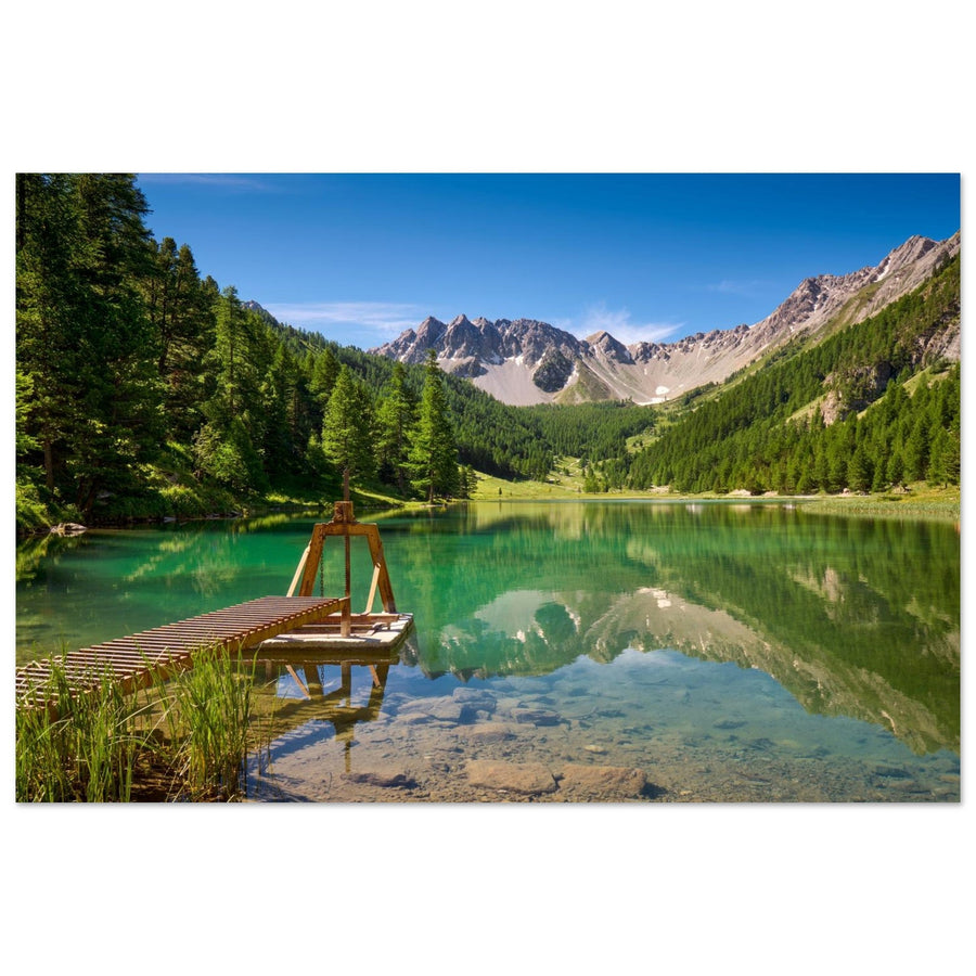
Ceillac concentrates the two most complementary lakes of the Queyras. Lac Miroir remains linked to larches, meadows, and reflections. Lac Sainte-Anne opens higher up in a mineral environment dominated by the reliefs of Font Sancte. Photographing them on the same day clearly shows the gradual transition from forest to high mountains.

At Lac Miroir, the main challenge is the state of the surface. A slight wind can eliminate the reflection, but it doesn't doom the image: the color of the water, the trees, and the shoreline lines can become the subject. A too-low viewpoint sometimes creates a large mass of water without structure. A few meters of height improve the readability of the lake and its surroundings.

At Lac Sainte-Anne, the composition depends more on the slopes, scree, and variations in water color. A wide-angle lens can work with a strong foreground, but a medium focal length often provides a more balanced image and avoids visually reducing the summits.

Photo print of Lac Miroir in Ceillac surrounded by larches in the Queyras
Lac Miroir combines reflections, larches, and the reliefs of Ceillac in a softer composition than the high passes. Photography by Picturereflex. View this photo print of Lac Miroir.

Read the detailed guide to Ceillac, Lac Miroir, and Lac Sainte-Anne.

3. Saint-Véran and Clausis Chapel: photographing an inhabited landscape

Saint-Véran adds a dimension to the Queyras cluster that passes and lakes cannot provide: architecture, village life, and the relationship between buildings and the mountains. Chalets, sundials, narrow streets, and snowy slopes allow for working with successive planes and a human scale.

The trap is to try to include everything in a single frame. A street, a facade, a succession of roofs, or a silhouette can be enough. At dawn and during the blue hour, the village lights create an interesting contrast with the snow or the still dark mountains. In autumn, the larches further connect the built environment to the landscape.

The Clausis chapel completely changes the scale. Isolated in the high Aigue Blanche valley, it can become an anchor point in a very open composition. A medium focal length allows showing the building without dwarfing the mountain; a telephoto lens brings the slopes closer and reinforces the impression of isolation.

Photo print of Saint-Véran under the snow with its chalets in the Queyras
Saint-Véran under the snow connects the village's architecture to the slopes of the Queyras. Photography by Francois Roux. Discover this photo print of Saint-Véran.

Read the detailed guide to Saint-Véran and the Clausis chapel.

4. Col Agnel, Agnel Refuge, and Pain de Sucre: the high Queyras

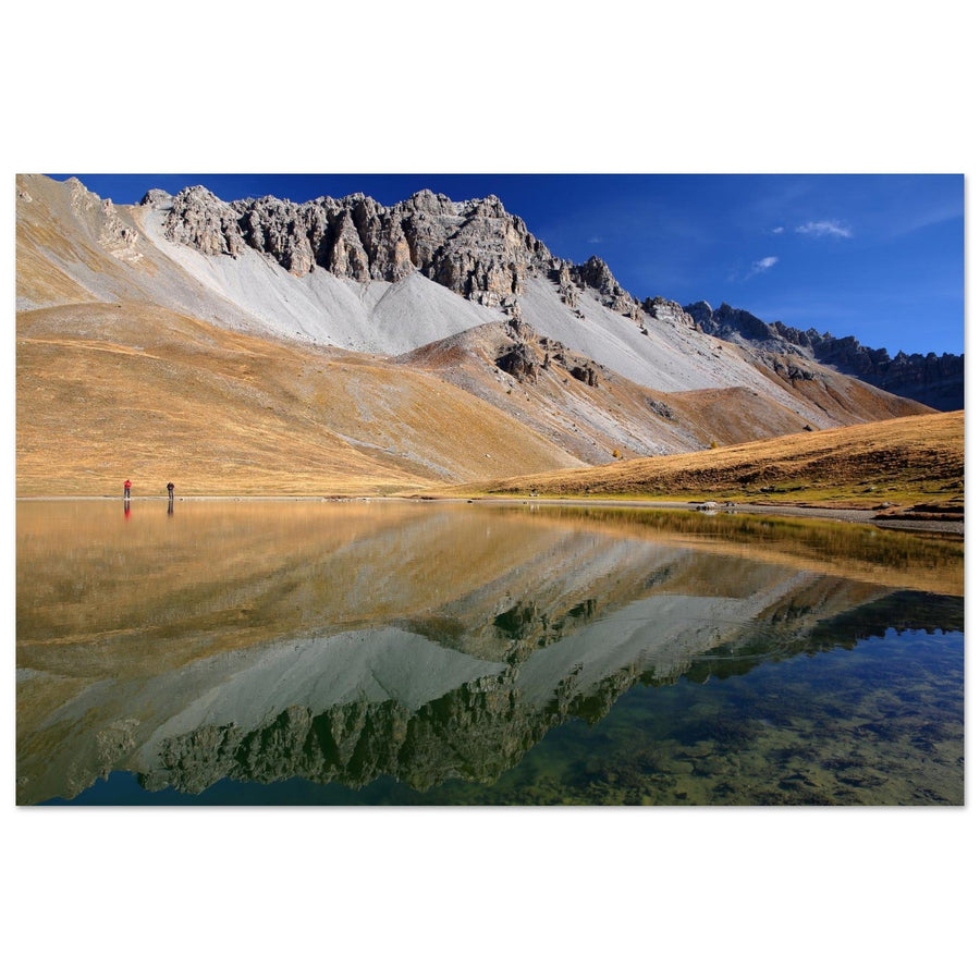
The road to Col Agnel traverses a landscape that gradually opens up. Trees disappear, alpine pastures take up more space, and shapes become simpler: a road, a refuge, a slope, and a ridge. This sobriety is particularly suitable for graphic compositions and medium focal lengths.

The Agnel refuge provides a landmark for scale and a human presence. The Pain de Sucre becomes a strong subject when the light accentuates its profile or when a first snowfall separates its lines. Views towards Mont Viso add extra depth, especially with a telephoto lens that brings planes closer without accumulating too much sky.

This sector is highly dependent on conditions. Wind, clouds, and seasonal closures can completely alter an outing. It is necessary to prepare several compositions that can be achieved from the valley or around the refuge, without considering access to the summit as essential.

Photo print of Col Agnel and Pain de Sucre in the autumn colors of the Queyras
Col Agnel and Pain de Sucre give the Queyras its high mountain face opening towards Italy. Photography by Francois Roux. View this photo print of Col Agnel.

Read the detailed guide to Col Agnel and Pain de Sucre.

5. Haut-Guil, Ristolas, and views towards Mont Viso: the wilder Queyras

Haut-Guil allows extending the view beyond the four most well-known sectors. Forests, torrents, valleys, and distant views towards Mont Viso create more discreet images, less immediately identifiable, but often more personal. However, the presence of protected areas requires more careful preparation.

Diffused light works well in undergrowth and near water. Conversely, ridge views benefit from being photographed with side light or clouds that separate the planes. In autumn, a telephoto lens allows isolating groups of golden larches on a dark slope without aiming for an exhaustive panorama.

In protected areas, photography must remain compatible with trails, wildlife tranquility, and local rules. A more distant shot at 200mm is often better than an approach that disturbs an animal or degrades a fragile environment.

6. Aiguilles, Château-Queyras, and inhabited valleys: completing the series

Queyras is not limited to high-altitude sites. Its villages, the Guil river, valley roads, and Fort Queyras allow for a more comprehensive portrayal of the region. These subjects are particularly useful when mountain peaks are covered or passes are closed.

A grey sky isn't necessarily a problem for architecture. It reduces contrasts and highlights details in facades, roofs, and fortifications. After a snowfall, the village and fort's lines become clearer. During the blue hour, a few artificial lights can frame the scene without turning the image into an urban view.

These areas also serve as a Plan B. A well-prepared outing should include a valley subject when wind, clouds, or traffic make high mountain passes unsuitable.

Which season to choose for photographing Queyras?

Spring: contrasts and still limited access

Spring can combine already green valleys with still snow-covered peaks. High-altitude access remains variable, and some routes are not yet suitable for a classic photo outing. It's best to prioritize villages, valleys, and accessible viewpoints, then carefully check conditions.

Summer: maximum access, more demanding light

Summer facilitates access to passes, lakes, and hikes. However, the light quickly becomes harsh, and crowds increase. Early mornings and late afternoons are more effective. Partial cloud cover adds relief to scree slopes and alpine pastures.

Autumn: golden larches and first snowfalls

Autumn is the most distinctive season. Larches turn golden, alpine pastures become ochre, and a first snowfall can highlight the ridges. The period is short: it's important to monitor color changes and have several alternative areas depending on the weather.

Winter: villages, forests, and graphic landscapes

In winter, high road passes no longer structure the itinerary in the same way. Saint-Véran, Ceillac, forests, and valleys become priorities. Snow simplifies compositions but requires careful exposure to retain details without greying out whites.

What camera gear to bring to Queyras?

  • 24–70 mm: the most versatile lens for roads, villages, lakes, and valley landscapes.
  • 70–200 mm: essential for isolating Rochebrune, the Pain de Sucre, illuminated larches, chapels, and layers of relief.
  • Wide-angle: useful by a lake or in a narrow street, only with a foreground that truly frames the image.
  • Light tripod: relevant for reflections, the blue hour, sunrises, and sunsets.
  • Polarizing filter: useful for managing certain reflections and enhancing colors, but to be used with caution with wide-angle lenses and at high altitudes.
  • Weather protection: rain cover, cloth, spare battery, and warm layer, even in summer.

For a hiking trip, it's better to have two lenses you've truly mastered than an overly heavy bag. Queyras lends itself well to the 24–70 mm and 70–200 mm duo, which covers most situations without encouraging you to shoot everything too wide.

How to organize a photo trip to Queyras?

Two days: choose two contrasting identities

Combine Izoard with Ceillac, or Saint-Véran with Col Agnel. The goal is to bring back a contrasting series without spending the entire trip in the car.

Three days: add a human element

A balanced itinerary could dedicate one day to mineral landscapes, one day to lakes, and one day to Saint-Véran. Keep the most stable day for hiking and use cloudy conditions for villages or forests.

Four days or more: plan a weather day

Add the Haut-Guil or inhabited valleys, but don't fill every slot. A flexible day allows you to return to an area when the light improves, which often yields more powerful images than simply visiting many different places.

Build the itinerary around the light

Group locations by valley and pre-determine two main compositions for each area. The weather then dictates the order. Passes are suitable for side lighting and clouds; forests better tolerate diffused light; villages work well early, late, or under a cloudy sky.

Regulations, weather, and safety in Queyras

Queyras is an inhabited, pastoral, and protected territory. Rules can vary according to municipalities, reserves, alpine pastures, and the season. One should not assume from a general authorization that a practice is possible everywhere.

In the field, keep your distance from wildlife, never block a road for a photo shoot, and calmly go around herds. Conditions can change rapidly between a sheltered valley and an exposed pass. A fallback plan should be in place before departure.

Mistakes to avoid when photographing Queyras

1. Wanting to cover the entire massif in one day

Distances may seem short on the map, but each area requires time for walking, observing, and waiting. Choose one valley or a couple of nearby locations.

2. Photographing all landscapes with a wide-angle lens

The wide-angle often reduces mountains and disperses elements. A telephoto lens is essential to clarify ridges, larches, and villages.

3. Only seeking blue skies

Rocks and scree gain relief under side light, clouds, or after a disturbance. A too uniform sky can make mineral landscapes appear flatter.

4. Confusing reflection with good composition

A perfectly calm lake is not enough. The reflection must extend a line, balance a subject, or create a deliberate symmetry.

5. Relying on a single pass or summit

Closures, wind, and clouds can make a goal impossible. Always prepare an alternative in the valley, forest, or a village.

6. Neglecting local rules

Restrictions regarding bivouacking, dogs, drones, and protected areas must be checked for the exact location. The quality of a photo never justifies disturbing wildlife or straying from an authorized route.

Our photographer's advice

In Queyras, build a series around contrasts rather than a list of sites. Combine a mineral scene, a plant scene, an inhabited landscape, and a high mountain image. You will get a more faithful reading of the massif than by repeating four wide-angle panoramas.

Also prepare a tight shot for each location. At Izoard, isolate a pinnacle or a hairpin bend. At Ceillac, work on a riverbank or a group of larches. At Saint-Véran, choose a facade or a succession of roofs. At Col Agnel, wait for a localized light to separate the Pain de Sucre from the slopes. These simpler images often retain more power when printed in large format.

Discover our Queyras photo prints

The collection brings together the main facets of the massif: mineral landscapes of Izoard, lakes of Ceillac, the village of Saint-Véran, Clausis chapel, Col Agnel, Pain de Sucre, and Pic de Rochebrune. Each photograph is attributed to its true author and offered as a photo print on matte aluminum Dibond, custom-made.

Discover all Queyras photo prints.

Some works related to Queyras

You can also explore Hautes-Alpes photo prints, autumn mountain landscapes, and our selection of mountain photo prints.

FAQ — Where to photograph Queyras?

What are the best places to photograph Queyras?

The four most complementary areas are Col d'Izoard and the Casse Déserte, Ceillac with Lac Miroir and Lac Sainte-Anne, Saint-Véran with the Clausis chapel, and then Col Agnel and the Pain de Sucre. The Haut-Guil and views towards Mont Viso complete a wilder series well.

What is the best season to photograph Queyras?

Autumn is the most distinctive season thanks to the golden larches and low light. Summer facilitates access to high-altitude passes and lakes, while winter provides more graphic images around villages, forests, and snow-covered valleys.

Where to photograph larches in autumn in Queyras?

The Col d'Izoard road, Ceillac, Saint-Véran, Molines-en-Queyras, and several valleys of the Haut-Guil offer beautiful combinations of larches, mineral reliefs, and first snowfalls. The side light of morning or late afternoon better captures the volumes of the forest.

Where to photograph lakes in Queyras?

Ceillac is the most obvious area with Lac Miroir, surrounded by larches and alpine pastures, then Lac Sainte-Anne in a more mineral cirque. Lac de Souliers offers a more open alternative near the Izoard area.

Where to photograph a village in Queyras?

Saint-Véran is the most visually striking village thanks to its chalets, sundials, narrow streets, and high-mountain environment. The Clausis chapel then allows for extending the series into a more open landscape.

Can Queyras be photographed without long hikes?

Yes. Several viewpoints around the Casse Déserte, Col d'Izoard, Saint-Véran, Molines-en-Queyras, and the Col Agnel road are accessible with little walking when the roads are open. The lakes of Ceillac and some summits require more effort.

What focal length to use for photographing Queyras?

A 24–70 mm lens covers landscapes, villages, and lakes well. A 70–200 mm is particularly useful for isolating ridges, Pic de Rochebrune, the Pain de Sucre, illuminated larches, or layers of relief. An ultra wide-angle is only useful if the foreground is truly structuring.

Is a tripod necessary for photographing Queyras?

A tripod becomes useful at sunrise, sunset, the blue hour, for reflections, and in dark alleys in winter. For a day hike, a light model is sufficient, and stabilization often allows for handheld shooting.

Are Col d'Izoard and Col Agnel accessible all year round?

No. These are high-altitude roads subject to seasonal closures and changing conditions. It is necessary to check road conditions on Inforoute Hautes-Alpes before departure and plan an alternative in the valley.

Can a drone be used in Queyras?

Drone use is strictly regulated by national regulations, municipal bylaws, and wildlife protection rules. Certain areas and situations prohibit takeoff, overflight, or approach. Official information from the Queyras Park must be consulted for the exact location and date of the outing.

Back to blog