Queyras | Photographing Col Agnel and Pain de Sucre
At Col Agnel, Pain de Sucre can dominate the whole image, remain a distant summit above the road or serve as a backdrop to the refuge. The same relief therefore changes role with every distance.
I begin by deciding whether I am photographing a high-altitude road, a refuge in the snow or the silhouette of the summit. You do not need to climb Pain de Sucre to build a strong image: from the valley and authorised surroundings, curves, slopes and layers of snow already create several scale relationships.
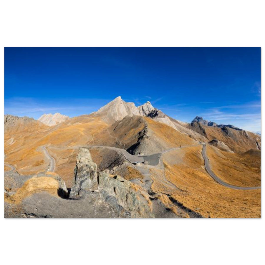
Opening photograph: Francois Roux — Col Agnel road and Pain de Sucre in autumn colours.
Before following the road
Do you want to show the valley, the refuge, the pass or the summit?
The area becomes stronger when a single scale dominates the composition.
A curve gives direction towards the pass and measures the slopes. Keep enough terrain around it so it does not become a simple strip of asphalt.
The building provides a very effective human reference, especially with snow. Leave visual distance between the roof and the silhouette of the summit.
As you approach the pass, the landscape becomes barer. Use slope lines and colour changes rather than a sign as the main subject.
A tighter frame can make the silhouette central. Wait for side light, a band of snow or a cloud that separates it from neighbouring ridges.
What altitude changes in the image
Lines become rarer, so each carries more weight
There are few trees to interrupt the curve. A small change in height is enough to reveal or hide its continuity.
Pain de Sucre is recognisable by its shape. It supports a clean frame provided it stays separated from the edge and neighbouring reliefs.
Russet grass, rock and snow change the contrasts of the valley. The composition should adapt to these bands instead of reproducing the same frame.

A road that measures the valley
The curve leads towards Pain de Sucre without taking its place
The road crosses russet slopes and then disappears. Pain de Sucre remains identifiable in the background, while bands of vegetation and rock create several depths in the valley.
Photograph: Francois RouxView the Col Agnel photograph →
What your distance changes
The summit grows, but the valley must not disappear by accident

A human measure in the snow
The refuge prevents the snowy valley from losing its scale
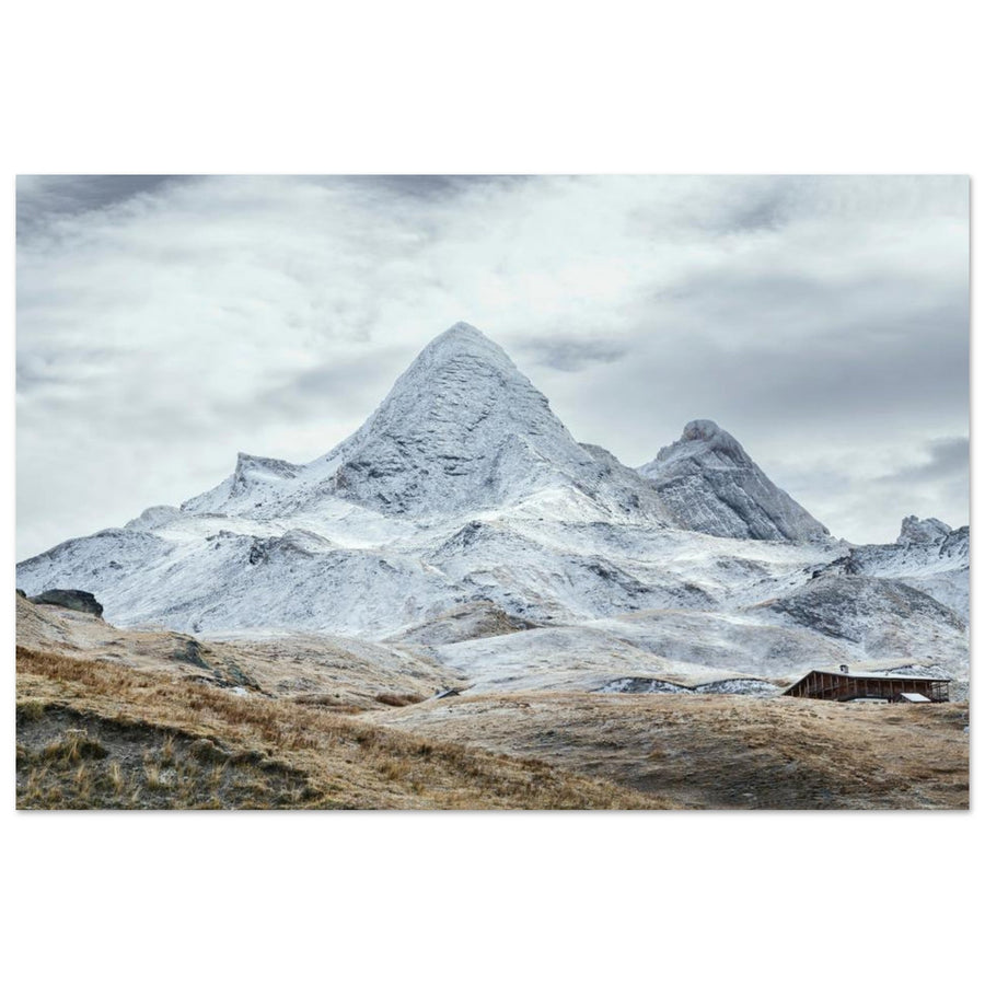
The dark building stands out against the snow and remains clearly smaller than Pain de Sucre. White slopes connect the two without merging them: the refuge anchors the foreground and the summit closes the image.
Photograph: G.Barattini-PhotographyView the Refuge Agnel photograph →
When the upper Queyras becomes generic
An isolated summit must still keep a link with the valley
Road, open slopes, refuge or successive ridges preserve the progression towards the pass.
Its silhouette is separated and its base keeps enough terrain not to float in the frame.
If the telephoto frame keeps only a lit piece of rock, the image can become a study of material rather than a photograph of the pass. This change is legitimate when it is acknowledged. To choose another area, return to the Queyras photo guide.
If the summit or road disappears
Change scale before looking for another point
Work with the valley
Frame the road, refuge and changes in material; the summit does not need to be visible.
Look for a line
A road curve, snow boundary or shadow on the slope can be enough to structure the frame.
Reduce the ambition
Stay in a safe, stable position. A tighter frame is preferable to an exposed move just to keep the summit.
Do not improvise access
The pass is seasonal. Choose an accessible valley subject and consult official road conditions.
Access and safety
The pass and the summit require two different terrain decisions
The Col Agnel road is a high-altitude road subject to seasonal closures and current conditions. Check its status on the day and use only authorised areas off the roadway. The Pain de Sucre route is a mountain hike: consult the official description, weather and route conditions before any ascent. A photograph of the area never justifies continuing when access or conditions are unsuitable.
Official sources
Check on the day of the outing
Road opening, weather, wind, snow cover, route condition and restrictions at the exact point.
If your difficulty is mainly technical
For snow exposure, telephoto sharpness or post-processing, continue with the technical guides.