Bauges | Photographing Mont Revard
A vastness that needs a focus
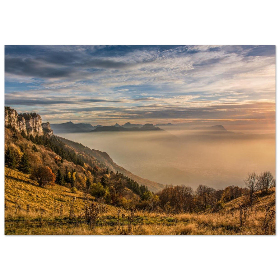
At Mont Revard, I wouldn't try to capture everything. I would first choose a direction — the lake, the misty layers, the heart of the Bauges, or a constructed foreground — then I would eliminate anything that blurs that depth.
The western edge opens up several landscapes at once. Without hierarchy, the lake becomes a light patch, the mountain ranges overlap, and the sky fills the empty space. A good image of Revard therefore begins with an act of renunciation.
Before lifting the camera
What depth do you want to start at Revard?
The view changes meaning depending on the element that initiates the frame.
Lac du Bourget becomes a breath between the edge and the mountain ranges. It must remain a surface that opens, not a clear band cut by the edge of the frame.
Mist, side light, or differences in value separate the planes. Without this separation, it is better to reduce the number of ridges.
A footbridge, a forest edge, or a plateau rim can provide the direction that the horizon alone does not give.
What the western edge makes possible
Revard is defined by the gap between near and far
The subject is not only what is seen in the distance, but how the edge of the Bauges opens the scene.
Woods, railings, trees, or the plateau's ground provide an immediate scale before the great distance.
The basin and the lake create a space between the Bauges and the Jura ranges; this separation must remain legible.
The lake, the Jura, the heart of the Bauges, and the distant Alps cannot all receive the same weight. The light must designate the winner.
The viewpoint is not enough
Shift the frame entrance before changing focal length
A few metres can change the angle, the amount of sky and the relationship between the edge and the distance. The guide to focal lengths and perspective clarifies what depends on position and what comes down to framing.

When the foreground dictates
The footbridge gives the panorama an unmistakable direction
The railings and the floor occupy a large part of the image, then converge towards the horizon. The reliefs remain soft and secondary: here, the belvedere structure is not an obstacle to hide, but the engine of depth.
Photography: Pierre Thiaville View the photograph of the Revard belvedereWhat must survive the framing
When does the image still speak of the grand balcony of Revard?
The local edge must explain the openness, even when the lake or a distant massif draws the eye.
A foreground of the plateau, a forest edge, or the edge of the belvedere organizes planes that truly open from the Bauges.
The Croix du Nivolet becomes the sole landmark, a forest closes off all depth, or a distant massif retains exactly the same strength without the local foreground.
The simplest test is to mentally mask the foreground: if the image loses nothing, you might be photographing another territory from Revard.
When the immensity no longer separates itself
Reduce the panorama instead of increasing the contrast
Plan B should simplify the scene on site, not artificially create layers afterwards that did not exist.
Introduce a nearby diagonal
A footbridge, a forest edge, or a slope provides an entry into the frame when distant planes appear to lie on the same surface.
Make the effacement the subject
Keep only the landforms that emerge clearly through the mist, or return to the plateau’s forests if no layer remains distinct.
Demand a response from the ground
The sky can dominate, provided that a terrestrial axis responds to it. Otherwise, the image ceases to tell the story of Revard.
Shift the axis without seeking the edge
Change position to find a clean line; no composition justifies crossing equipment or exposing oneself.
A belvedere remains a real place
Prepare for the chosen orientation, not just the arrival at the panorama
The Geopark indicates access via the Revard road or the Col de Plainpalais, as well as pedestrian access from Aix-les-Bains. This information may change with the season, ongoing work, and conditions: check it before you go and stay within the authorized areas of the belvedere.
To check before the outing
Choose the useful orientation and check anything that might modify access or the reading of the planes.
- Road conditions, parking, and pathways
- Visibility towards the lake or the heart of the Bauges
- Wind, humidity, snow, and belvedere traffic
Official sources
The Park describes the geology, the directions of the panorama, and the reference access points.
When the gaze leaves the horizon
Continue towards the subject that has truly taken control
Two useful shifts from Revard
Follow the landmark or material that replaces the grand panorama.
Return to the choice of massif
The general guide compares panorama, landmark, karst, fold, and nearby subjects.
Extend your view of Le Revard
To compare other foregrounds and light in the same area, the collection brings together photographs of Grand Revard and La Féclaz.