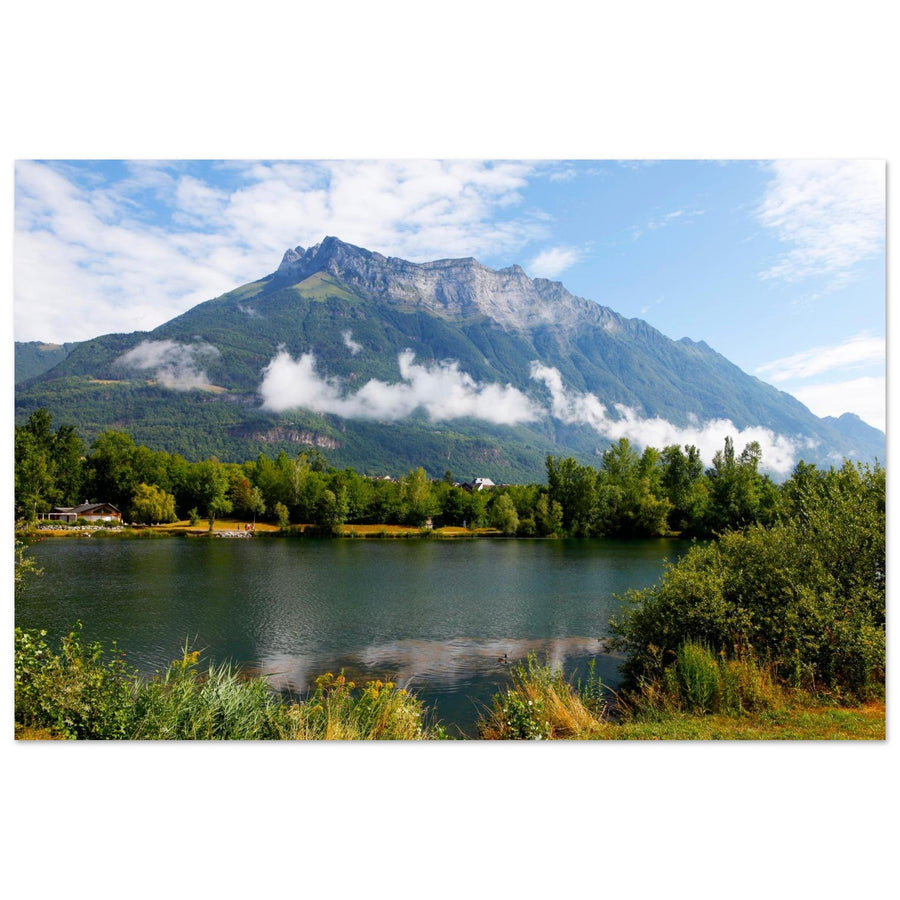
Bauges | Photographing the Dent d’Arclusaz
A mountain that reads like a fold
To photograph the Dent d'Arclusaz, I would choose a distance that preserves its logic before choosing the foreground. The syncline can hold by its continuity, by a portion of wall or by its relation to the foothills.
The lake, meadows, villages, and valley provide a useful base, but none should cut or lighten the mountain to the point of turning it into scenery. The Arclusaz already has a geometry; the composition should make it more evident.
Before the Foreground
Which part of the geometry should carry the image?
The chosen relationship determines the distance and the amount of foothills to keep.
From the foothills, the length of the fold becomes the main argument. The bottom of the frame must anchor it without fragmenting its line.
A tighter framing can show the structure of the limestone, provided a connection that remains unique to the Arclusaz is maintained.
Water, meadow, orchard or village provide a strong scale. They must remain a base, not a second story of equal weight.
What distinguishes the Arclusaz
Following a long mountain rather than an isolated peak
The Dent is not just a high point: it belongs to a folded structure whose edges and slopes echo each other.
The continuity of the top of the relief gives it its amplitude. Cut it only if a portion retains enough tension to remain identifiable.
Forests, slabs, and converging slopes build a more complex mass than a simple pyramid.
From the Combe de Savoie, the low, inhabited lines make the wall much more imposing without requiring physical proximity.
The mountain doesn't have the same shape everywhere
Use distance to choose between continuity, base, and material
Each position changes the amount of visible fold and the relationship between the wall and the foreground.
The base must support, never cut
Make the foreground a pedestal for the long wall
The Arclusaz tolerates very different foregrounds if their geometry reinforces the continuity of the relief.
Keep a stable horizontal line
A calm strip of water provides a base for the fold. Too much water reduces the mountain; too little creates a break with no purpose.
Use low lines to set the scale
A continuous edge or a few grouped trees anchor the relief better than an inventory of scattered details.
Keep at least one wall connection
The mist can increase the volume, but it must not cut off all the clues that connect the Dent to the rest of the syncline.

A calm base for a massive mountain
The lake opens the frame without interrupting the line of the Arclusaz
The water forms a large horizontal, then the wooded shoreline establishes a second band before the slope rises. Clouds locally cut through the forest, but the wall remains continuous and clearly dominates the scene.
Photography: Laurens Jobse View the photograph of Lac de Carouge and the ArclusazThe fold must remain irreplaceable
When does the foreground stop serving the Arclusaz?
The lake, village, or alpine pasture are only useful if they increase the weight or readability of the mountain.
The continuity of the fold, a recognizable wall, or the convergence of the slopes remains the primary reason to look.
The water, houses, trees, or ambiance would have the same force in front of any mountain, and the Arclusaz could be replaced.
A strong base is not a problem; it only becomes another subject when it no longer needs the geometry of the relief.
When the fold fragments
Find a continuous line before adding decoration
Each correction must make the structure more legible, not simply fill the frame.
Wait for a connection or isolate a wall
A partial opening may be sufficient if it still connects two pieces of the structure. Otherwise, commit to a tighter framing.
Reduce the water and raise the mountain
Keep the useful horizontal, but restore to the relief the necessary surface to assert its mass.
Seek lateral separation
A wall shadow, an edge, or localized mist can reveal volume better than a global contrast added afterwards.
Step back
If the slabs become anonymous, step back until you find the relationship between the Dent, wall, and slopes.
A protected and inhabited geometry
Adapt the project to the actually chosen foothills or slope
Rando'Bauges indicates that the observable slope belongs to the Hautes-Bauges Natura 2000 site and describes sensitive alpine pasture environments. A view from the foothills and an approach into the valley do not involve the same terrain. Check the itinerary, instructions, weather, and daily pastoral activities.
To check before going out
The chosen photographic distance also determines the necessary preparation.
- Access and parking at the low viewpoint
- Trail conditions if entering the valley
- Weather, clouds on the wall, pastoralism, and Natura 2000 guidelines
Official sources
Rando'Bauges documents the geometry, foothills, and natural challenges of the slope.
When the mountain loses its weight
Switch to material or panorama depending on what remains
Two routes for a different scale
Follow either the detail of the limestone or the depth of the horizons.
Return to the choice of territory
The parent guide compares other possible geometries in the Bauges.