Belledonne | Photographing Lac du Crozet and the Doménon Lakes
Belledonne · project 01
Photographing Crozet and Doménon means making a progression visible: first a threshold lake still connected to the Grésivaudan, then high-mountain waters held in granite.
The trap is producing two interchangeable lake images. To preserve the subject, Crozet must show an opening, a shoreline or a break in slope; the Doménon lakes must tighten the reading towards altitude, material and isolation.
Initial decision
Which act should carry the main image?
Both lakes belong to the same route, but they do not require the same hierarchy.
Keep a shoreline, side relief or the opening downstream to show that the water marks a transition rather than a closed basin.
Reduce the outside horizon and let rock, slopes and dark water create a high-mountain feeling.
Make an open image and a tightened image answer one another through the same thread: water surface, scale and direction of ascent.
Local signature
What distinguishes Crozet–Doménon from a simple lake series
The signature lies in the shift between a lake balcony and a higher, more mineral basin.
At Crozet, the raised shoreline and break towards the valley can preserve the link with the Grésivaudan and Chartreuse.
As you climb, blocks, slabs and slopes take more space. The lake stops standing alone and becomes a surface within the mineral landscape.
At Doménon, a shoreline detail, snow patch or repeated layers are needed to avoid a rock mass with no depth.
Real positions
What movement changes in the image
The progression is not a narrative added afterwards: it must be demonstrated through different geometries.

Artwork · act 1
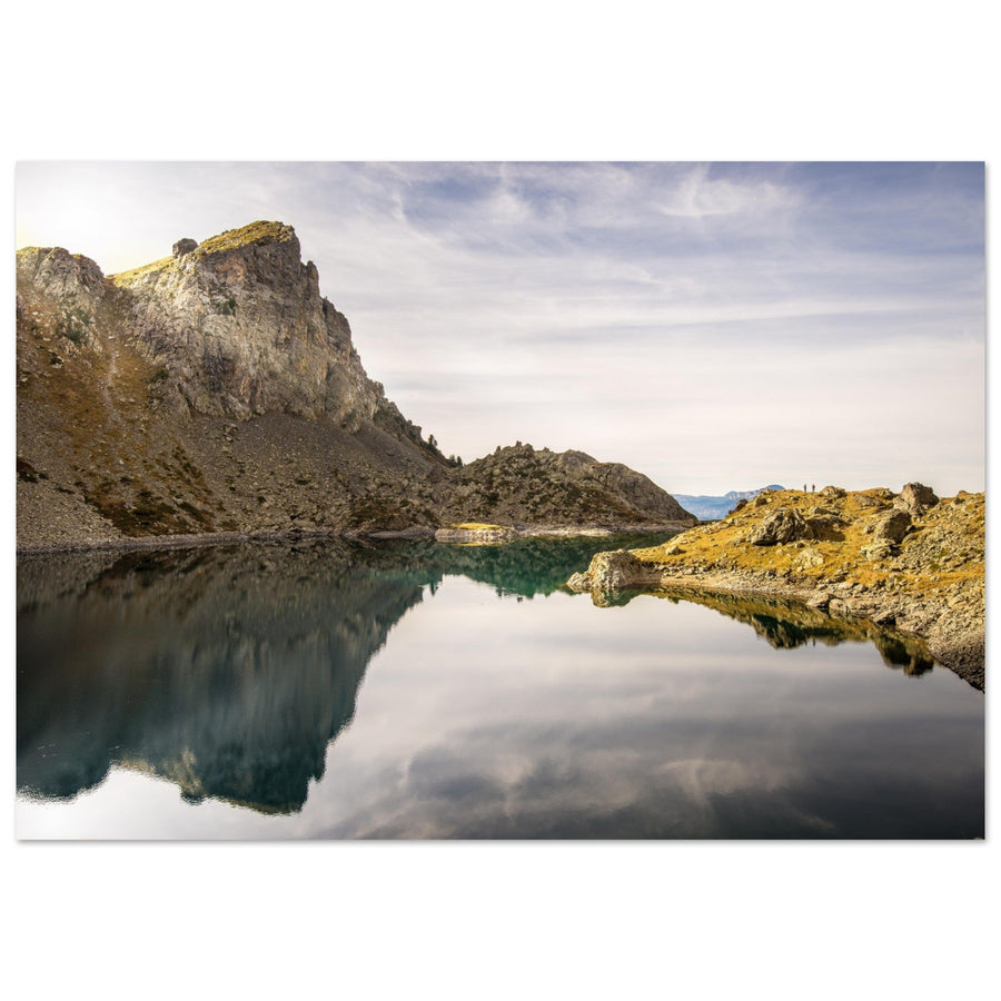
At Crozet, the shoreline closes the reflection without erasing the threshold
The calm surface brings together rock, cliff and light. The small opening beyond the lake nevertheless prevents the image from becoming a completely closed basin.
Photograph: Pierre ThiavilleView the Lac du Crozet artworkArtwork · act 2
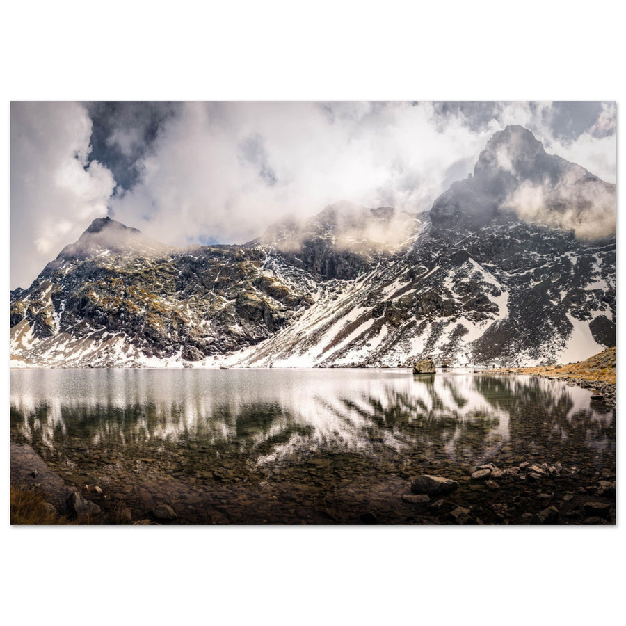
At Grand Doménon, water becomes the counterweight to the mineral terrain
Dark rock, clouds and snow patches occupy almost the entire field. The lake keeps breathing room low in the frame and proves the change of register.
Photograph: Pierre ThiavilleView the Grand Doménon artwork
Composition consequences
Make the ascent tangible without illustrating an itinerary
The progression remains photographic: it comes through openness, density and scale, not a documentary sequence of signposts.
Keep a direction of escape
Place the shoreline or horizon so it indicates that the lake lies on a passage between valley and altitude.
Increase the weight of the mineral terrain
Give slopes and blocks more space, but keep enough of the water line for the basin not to disappear.
Repeat a form, change the space
A common shoreline, reflection or diagonal connects the images; the degree of openness distinguishes them.
Editorial boundary
When is the image still about Crozet–Doménon?
The subject holds as long as water makes the passage between two registers of the massif readable.
At Crozet, water, a structuring shoreline and an opening share the hierarchy. The image keeps the first act.
At Doménon, water responds to slopes and rock. Isolation is readable without reducing the scene to a summit.
If the outside horizon dominates, Crozet becomes a panorama. If rock erases the water, Doménon becomes a slope study.
Failures and backup plans
What breaks the progression and what to change
Do not force the diptych if one of the two acts is no longer safe or readable.
The reflection loses its function
Frame blocks and the break in slope, or accept a texture image. Do not build the entire first image around a mirror that is absent.
Doménon lacks scale
Move closer to the shoreline and use water, snow patches or blocks as successive layers instead of waiting for an invisible summit.
Backup: stay with the first act
A coherent Crozet outing is better than extending the climb beyond your skills, time or available conditions.
Backup: vary density
Strengthen the difference through materials and layers rather than waiting only for a spectacular colour contrast.
Terrain and sources
Prepare for a genuinely longer progression
The classic approach climbs from Pré Raymond towards Crozet, the pass and Refuge de la Pra; reaching Doménon extends the commitment. Snow, storms and fatigue can turn the second act into a poor decision.
Set a return time, an altitude limit and a complete photographic solution at Crozet before leaving.
Check before the outing
Terrain information is volatile and must be re-read on the day of departure.
- Weather, storms, wind and visibility at altitude.
- Remaining snow and condition of passages towards La Pra and Doménon.
- Access to the trailhead, travel time and return time.
- Refuge staffing or booking if the refuge is part of the project.
- Local rules for the protected area.
Official sources
These pages provide the current framework; they do not replace the day's weather or personal assessment.
Other Belledonne projects
Continue the Belledonne project
Useful neighbouring projects
Change page when the project becomes a contrast between two atmospheres or a system of several basins.
Return to choosing the territory
The Belledonne page compares the four active relationships before choosing another subject.