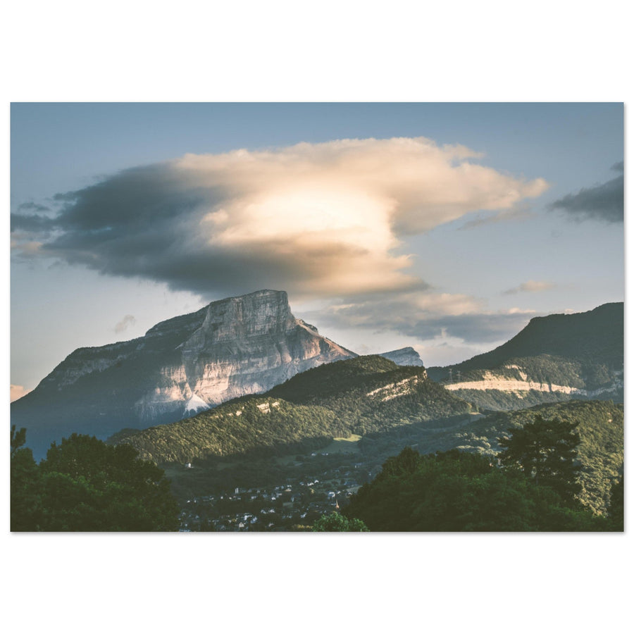
Chartreuse | Photographing Mont Granier
Photographing Mont Granier
Photograph Granier from a distance that explains its shape: a close cliff, a mountain above the vineyards, or a silhouette set within the Entremonts valley.
Its limestone wall, rockfall scars and contrast with wooded slopes give it an immediate identity. The first choice, however, remains an authorised and safe area: no frame justifies approaching a prohibited sector.
Initial decision
What relationship should tell the story of Granier?
The same cliff changes role with distance and with the landscape retained at its foot.
Limestone and forest occupy almost the whole frame; breaks in material make the image.
Vines, lakes and small hills tell the story of foothills shaped by the collapse without taking priority from the wall.
Meadows, hamlets and forest edges give Granier scale from the Entremonts.
Photographic signature
What makes Granier immediately identifiable
The strength of the subject comes from the relationship between pale mass, rock scars and vegetated slopes.
Its height reads better with a wooded base or measured foreground than with too much sky.
Light and dark areas tell the story of rockfalls; side light preserves their relief.
The Abymes, vineyards and lake depressions connect the mountain to a landscape that belongs to it.
Local readings
What position changes
Move closer to read the material; move back to tell the story of the relief's footprint.

Evidence of hierarchy
The pale rock remains the entry point
The forest forms a dark base and measures the wall without splitting attention. Shadows reveal folds in the limestone while preserving a simple silhouette.
Photograph: Pierre ThiavilleView this artworkSubject boundary
Is the image still about Granier?
The wall must remain the visible cause of the frame's organisation.
Vines, lake, forest or hamlets lead towards the cliff and give it scale.
Rows and ground details occupy most of the image: the mountain becomes a background.
Homes and transport routes primarily tell the story of the Entremonts, even if Granier remains visible.
Failures and backup plans
What makes the image fail and what to change
Safety and permission to access the area are the first filter.
Change distance
Return to an authorised point at the pass, vineyards or valley; never compensate by moving closer to the cliff.
Reduce to the wooded base
If the cliff is no longer identifiable, work with forest edges and lower relief or postpone the Granier portrait.
Use shores and vineyards
Build a terrestrial progression towards Granier instead of forcing symmetry that the wind prevents.
Simplify the lines
Choose one vineyard curve, forest edge or discreet hamlet so the cliff becomes dominant again.
Terrain and sources
Prepare for the real terrain
Municipal orders restrict access to certain areas on and below Granier because of rockfalls. The trail along the north face, immediate access to the cross and the Pas de la Porte trail are listed as prohibited by the Park.
At Lac Saint-André, respect paths, parking areas and vineyard plots. A photographic position gives no right to enter private land.
Check before the outing
Restrictions and ground conditions take priority over the planned route.
- prohibited areas and current orders;
- weather, falling rocks, snow and trail conditions;
- road access and parking;
- local rules around the lake and vineyards.
Official sources
Check this information before every outing.
Next links
Continue the project
Useful next projects
Compare another way of giving scale to relief.
Return to choosing the territory
The Chartreuse guide compares four photographic approaches and their alternatives depending on conditions.