Mont-Blanc | Photographing the Mer de Glace from Montenvers
Photography project · Montenvers
Photographing the Mer de Glace from Montenvers means showing a glacier in its real landscape: a curve of ice and moraine, human references, and visible traces of a relief that is changing.
The basin is spectacular, but its photographic strength does not come only from the Grandes Jorasses or the Drus. Stairs, station, train, level lines and polished rock provide scale to the glacier and make its evolution readable.
Choose between three narratives: the form of the basin, the scale provided by infrastructure, or the material observed at closer range.
Central decision
What story of the Mer de Glace do you want to show?
The basin contains a lot of information. Give one relationship priority, then use the others as references.
Frame its curve, moraines and rock threshold as successive layers. The summits close the image without becoming its only subject.
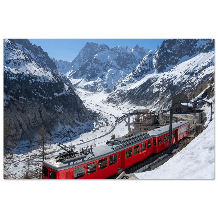
The red line and passengers reveal the size of the slope. Infrastructure should interact with the glacier instead of relegating it to scenery.
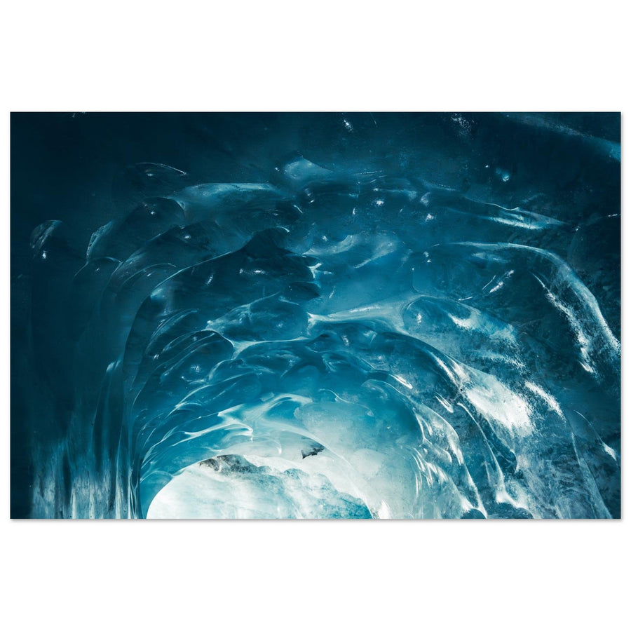
Ice, debris, water and rock tell a composite landscape. Tighten the frame so the texture keeps a direction instead of becoming an inventory.
Signature of the place
The signs that identify Montenvers
The signature comes from the encounter between immense glacial geography and very precise human references.
The basin leads the eye upstream. An effective composition uses its edges as active lines and avoids cutting the ice into flat bands without depth.
Train, station, terraces and stairs give the walls a size. Their geometry can provide the only clean line in a highly textured landscape.
Exposed rock, successive levels and access paths inscribe time into the image. Showing them requires a clear composition, not an accumulation of evidence.
Compared positions
What position around Montenvers changes
Moving from the viewpoint to the station and then to lower authorised access changes relative height, foreground and proximity to the ice.

Evidence from the image
The train makes the wall measurable
The red line gives a unit of size to the mineral world and leads towards the Grandes Jorasses. Infrastructure does not distract from the landscape: it reveals its scale.
Photograph: Francois Roux View this photograph of the Montenvers trainThe subject of the image
When does the Mer de Glace remain the real subject?
The glacier remains central when it organises the lines, scale or narrative of change. If it becomes a thin patch in the background, the image is about something else.
Ice, moraine and basin control the depth; train and buildings provide scale or punctuation.
The train, station or passengers become the main action while the ice is only a recognisable background.
The Grandes Jorasses or Drus alone dominate the composition and the glacial form no longer explains their relationship to the place.
The test is simple: if removing the glacier changes almost nothing in the reading, the project is no longer about the Mer de Glace.
Useful failures
What makes the image fail and what to change
Conditions that are weak for a panorama can become strong for material, the train or a documentary narrative.
Tighten on texture and level lines
Colour loses strength, but moraine, ice folds and polished rock keep structure. Look for one main direction.
Make the basin a closed image
Use the cloud ceiling as a boundary and favour the glacial curve, station or train. The absence of distance concentrates the narrative.
Embrace a more precise frame
Change height slightly, wait for an isolated silhouette or use infrastructure as geometry. Avoid cutting a group without intention.
Build a document from the surface
The viewpoints are enough to compare ice, moraine and exposed rock. A coherent image never depends on unconfirmed access.

A real change of scale
Ice becomes a close-up subject
The blue vault and its striations fill almost the entire frame; a bright opening gives the eye a direction. The valley and train have disappeared. This is an example of viewing the ice at close range, to consider only if the relevant access is actually open.
Photograph: Sylvain Felten View the textures of the ice caveReal terrain
Prepare Montenvers without assuming access
The train, facilities and lower access have their own schedules, constraints and operating periods. Check official information on the day and allow comfortable time for the return.
The developed site remains a mountain environment. Cold, altitude, stairs, snow and rapid changes in visibility require suitable preparation; this photography guide does not replace local instructions.
Check before the outing
Check everything that genuinely determines the project.
- train opening and schedules, possible booking and last return;
- operation of facilities and authorised access to lower levels;
- number of steps, effort, equipment and available time;
- weather, visibility, snow, wind and on-site instructions.
Official sources
Consult the operator for access and local organisations for mountain conditions.
Continue the project
Compare other relationships with the massif
Useful neighbouring guides
Change hierarchy while staying in the same massif.
Return to choosing the territory
Compare valley, glacier and high-altitude projects with external viewpoints.