Aravis | Photographing Pointe Percée
A profile to protect
Photographing Pointe Percée means choosing the distance that keeps its silhouette readable, then adding only the terrain that can explain that distance.
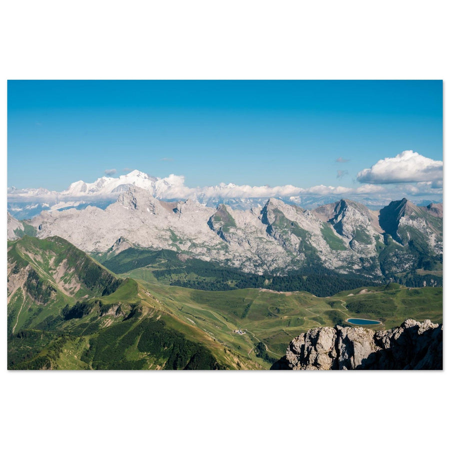
From the valley, the summit dominates an inhabited landscape; at Col des Annes, the alpine pasture brings the layers closer; towards Gramusset, limestone and the refuge shift the image towards mineral terrain. The subject remains the same, but its size, angle and material change.
Decide before walking
How much weight should Pointe Percée have in the image?
The right approach depends less on the number of metres than on the relationship you want between silhouette, human scale and material.
Keep meadows, chalets or valley lines to measure the height without reducing the summit to a small tooth in the background.
At Col des Annes, choose a single human landmark or one slope line; an accumulation of buildings scatters the silhouette.
Reduce the grass, let blocks and lapiaz lead the eye, then use the refuge as a measure rather than as the main destination.
What must not disappear
Recognise Pointe Percée before looking for beautiful light
Its signature comes from a broken, directional profile, not merely from being a limestone summit.
Leave enough space on the side towards which the ridge leads the eye; mechanical centring weakens that direction.
From below, control distracting layers; closer in, make sure the mass does not cut off the decisive part of the shape.
This transition gives the series progression: the summit does not merely change size, its visual world becomes tighter.

Constructed scale
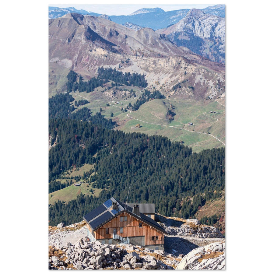
The refuge measures the change of world
The building remains small but precise at the edge of the limestone. Behind it, alpine pastures and layered relief make the transition between mineral proximity and the depth of the massif visible.
Photograph: theoballet View the artworkThree changes of scale
From Le Bouchet to Gramusset, shift the relationship rather than repeat the panorama
Each family of positions should give the foreground a different function.
The summit or its setting?
When is the image still about Pointe Percée?
The name of the shooting location does not determine the subject; the hierarchy of the frame does.
Its profile directs the frame, its size organises the layers and the foreground explains the distance from which it is seen.
The valley floor, chalets and walls tell a complete space; the summit merely closes or locates the scene.
If the Aravis terrain can be almost entirely cropped away without loss, the image should be pursued as a Mont-Blanc subject.
To keep an inhabited valley as the subject, continue with the photographic reading of Doran.
What erases the profile
Repair a Pointe Percée that has become generic
The backup plan should restore the silhouette or embrace a closer subject.
Move down towards human scale
Give up the summit portrait and use a chalet, the refuge or lapiaz as a temporary subject, with the hidden mass only as context.
Choose a single landmark
Move sideways to isolate one slope line or building; several competing pastoral signs make the direction of the profile disappear.
Work with the break between material and sky
Reduce featureless surfaces and use the cloud edge, remaining snow or a dark ridge to restore separation to the summit.
Return to a safer distance
A valley or pass view can preserve the profile without continuing onto a steep, snowy or exposed trail.
The project stops where the commitment changes
Prepare for Gramusset without promising conditions
Le Grand-Bornand distinguishes several routes to the refuge and describes rockier terrain around Gramusset. Durations, parking, transport, refuge staffing and trail condition must be checked again in the day's information.
The refuge is a place of welcome and safety. Access, bookings and other users take priority over photographic setup.
Check before the outing
Check what genuinely changes the level of commitment.
- snow, wind, visibility and condition of rocky passages;
- parking, shuttles and authorised access;
- refuge staffing, bookings and instructions;
- presence of livestock and use of alpine tracks.
Official sources
Return to the most recent local information.
Change subject without blurring the series
Continue from the boundary of Pointe Percée
Two useful shifts
Leave the summit portrait when the valley or family of reliefs becomes more important.
Return to choosing the massif
The general page compares silhouette, valley, combes and the summit-lake system.