Vercors | Photographing Combe Laval
Combe Laval photo guide
Photographing Combe Laval means choosing what should reveal the scale of the reculée: the road cut into the cliff, the succession of walls and forests, or the water running through its interior.
The road immediately attracts the eye, but it explains the landscape only if it remains a line of scale within a larger space.
Initial decision
Which line should lead the eye into the reculée?
Composition changes depending on whether you view the road from outside, stand on the structure, or enter the forests and valleys. Choose that depth first.
From an opposite viewpoint, the road becomes a thin line in the wall. It conveys the height as long as the frame keeps enough cliff and void.
At tunnel and wall level, use curves, openings and drops to build progression. The reculée must remain perceptible behind the detail.
In the woodland, water, tufa and openings towards the walls replace the road as structure. The photograph becomes more intimate and less immediately recognisable.
Photographic signature
Three elements give Combe Laval its depth
The reculée is understood through the relationship between its walls, forest cover and the human or natural lines crossing it.
The cliff is not merely a background. It sets the limits, height and direction of the space. Too tight a frame turns the reculée into a simple limestone wall.
Tunnels, parapets and curves provide human scale. Their fineness compared with the wall makes the size of the site understandable.
Forest edges, openings and small valleys create several layers. Inside, the Cholet and tufa formations can become the main thread.
Local readings
The viewpoint decides whether the road, reculée or interior dominates
These positions are not a list of stops. They demonstrate four incompatible ways of hierarchising the same site.

Evidence of a road put to scale
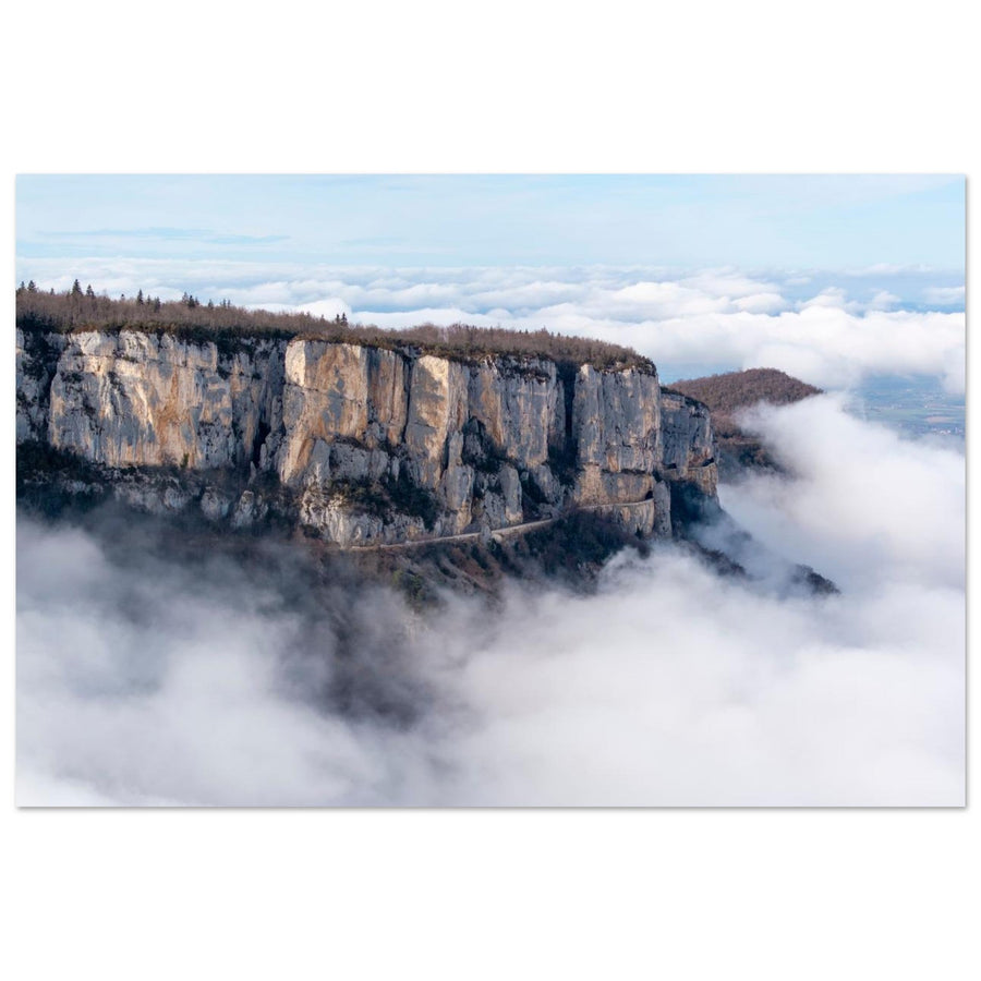
The cloud layer reveals the road as a line in the wall
The structure remains identifiable, but the width of the cliff and depth of the atmosphere dominate. The photograph is first about the relationship between human construction and reculée.
Photograph: Louise.sView the Combe Laval road artworkSubject boundary
When are you still photographing Combe Laval?
Recognising the place is not enough. The reculée must still organise the layers or give scale to what crosses it.
Walls, void and forest build the depth. The road or water gives it scale and direction.
Tunnels, walls and curves dominate the image. The cliff then serves as context for a human structure.
The inner valley carries the composition. Combe Laval remains the territory, but the photograph no longer depends on its large form.
The right boundary excludes none of these images. It simply avoids giving them the same intention.
Failures and backup plan
When the view closes, change scale
Mist, rain or traffic can make the large reading impossible while leaving a closer image available.
Work with a forest-edge relationship
Use an opening between forest and cliff only if it preserves depth. A wall without scale does not replace the grand view.
Move back or embrace the structure
If parapets and roadway fill the frame, stop claiming to show the reculée. Choose an outside point or deliberately build an image of the road.
Leave the inner valley aside
Crossings and areas near the Cholet can become difficult. Stay with a safe reading from authorised areas rather than forcing access to the water.
Terrain and sources
The road and water impose their own limits
Combe Laval includes a narrow road, viewpoints, cliffs and a sensitive natural area. Traffic, possible closures, parking and protected zones must be checked before choosing any position.
Inside, routes around Saint-Laurent, Cholet and Frochet cross a fragile environment. Tufa formations and water edges demand particular care, especially after rain.
Check before the outing
A beautiful line justifies neither a dangerous stop nor a fragile crossing.
- traffic, closures and authorised parking;
- weather, mist and visibility in the reculée;
- water level and condition of crossings;
- rules of the sensitive natural area.
Official sources
Re-read route and area information before setting out.
Continue the project
Change guide when the space opens up
Two neighbouring guides
Continue towards a different landscape structure.
Return to choosing the territory
The Vercors guide compares silhouette, open space, ridges, reculée and plateaus before choosing a new area.