Vercors | Photographing Mont Aiguille
Mont Aiguille photo guide
Photographing Mont Aiguille first means preserving the clarity of its silhouette, then deciding what should give it scale: the inhabited Trièves, the eastern barrier or the space that isolates it.
The mountain changes strongly in profile and presence as you move around it. A place is therefore useful only if it explains a difference in geometry, background, foreground or hierarchy.
Initial decision
What relationship do you want to establish with Mont Aiguille?
The same relief can become an isolated icon, a mountain given human scale by its foreground, or an element of the eastern barrier. Distance and position establish that relationship first; focal length then serves the hierarchy you have chosen.
Move far enough back to preserve the isolation of the butte and a clear separation from neighbouring reliefs. The background should reinforce the profile, not absorb it.
Include fields, hamlets or forest edges from the Trièves. These elements explain the mountain's height and presence as long as they remain secondary landmarks.
Widen the frame to show its relationship with Grand Veymont and the ridges. This reading gains territory but makes the hierarchy more fragile.
Photographic signature
Three properties must remain readable
Recognition depends less on size in the frame than on the combination of profile, isolation and scale.
Mont Aiguille is an isolated erosional outlier, separated from the eastern barrier by erosion. The space around its flanks should make this separation clear.
The apparent width of the summit plateau, the verticality of the faces and the position of the ridges change as you move around it. A series can exploit this transformation; a single image must choose its profile.
Villages, fields and forests make the height understandable. Conversely, a foreground that is too massive can compress the silhouette and shift the image towards the Trièves or the eastern barrier.

Isolate the shape
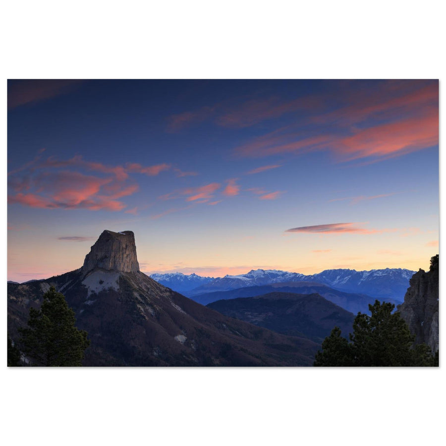
The profile remains strong despite its small size
Mont Aiguille stands out against the distant ranges and pink sky. Nearby trees remain secondary: the monolith makes the place recognisable. The view of Chichilianne further on will show, by contrast, how buildings give it a sense of scale.
Photograph: Sander van der Werf View the silhouette of Mont AiguilleLocal readings
Position changes the profile, background and hierarchy
The areas below are not a list of spots: each demonstrates a precise photographic transformation.

Evidence of inhabited scale
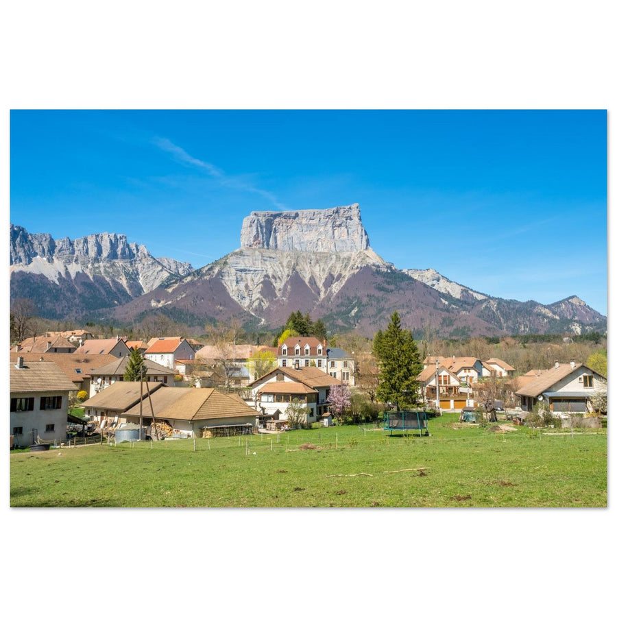
Chichilianne turns height into a relationship
Houses and plots provide a measure of the relief. Yet the mountain remains dominant thanks to its central position, complete profile and visual continuity rising from the village towards the butte.
Photograph: jeafish Ping View the Chichilianne artworkSubject boundary
When are you still photographing Mont Aiguille?
The answer depends on which element organises the reading first and on what would disappear if the mountain were removed from the frame.
Its profile controls the space, the position of foregrounds and the direction of the eye. The village or ridges serve its presence.
Ridge lines and the mass of the highest summit organise the frame; Mont Aiguille becomes a landmark in an image of the eastern barrier.
Villages, plots or valley depth carry the narrative; the mountain then gives the background its identity rather than the main hierarchy.
This shift is not a flaw. It simply indicates which guide and which project should now lead the photograph.
Failures and backup plan
Do not force the silhouette when it no longer exists
The backup plan should preserve a real photographic relationship, not merely move the tripod.
Work with close scale or change subject
If the summit plateau and ridges can no longer be read, use fields, forest edges or a layer of mist only if they still form an autonomous image. Otherwise, leave the Mont Aiguille portrait behind.
Recover a separation or embrace the eastern barrier
Change the angle slightly or widen clearly. An in-between frame where the masses overlap weakens both the silhouette and the massif landscape.
Choose a shorter reading
The official circuit is difficult and can become slippery in rain. An approach from Chichilianne or Col de l’Allimas lets you work with a precise relationship without turning photography into an itinerary objective.
Terrain and sources
Prepare for the real commitment before choosing the position
The official Mont Aiguille circuit is classified as difficult: 17.5 km, about 6 hours and 1,116 m of ascent. It crosses the Hauts-Plateaux Reserve several times. The Col de l’Allimas offers a shorter, easy loop, but no route description replaces checking weather, access and regulations before setting out.
Climbing Mont Aiguille is a separate technical practice and is never necessary for creating the images described here.
Check before the outing
Conditions may make a position or circuit unsuitable.
- condition of access, trails and parking areas;
- rain, fog, wind and visibility on the ridges;
- Reserve boundaries and applicable regulations;
- self-sufficiency, water and a realistic schedule.
Official sources
Re-read the information corresponding to the route you actually choose.
Continue the project
Change guide when the hierarchy changes
Two neighbouring guides
Continue towards whichever subject now carries the image.
Return to choosing the territory
The Vercors guide compares silhouette, open space, ridges, reculée and plateaus before choosing a new area.