Où photographier le lac de Roselend, Roche Parstire et Saint-Guérin ? - AluArtMountains

Where to photograph Lake Roselend, Roche Parstire, and Saint-Guérin?

Published on July 30, 2026

Lake Roselend, the ridges of Roche Parstire, and Lake Saint-Guérin form one of the most cohesive photographic ensembles in the Beaufortain region. Roselend offers vast perspectives towards the alpine pastures and peaks. Roche Parstire overlooks the lake, allowing for multi-layered compositions. Saint-Guérin presents a different, more intimate view, where the lines of the dam, the curves of the reservoir, and the footbridge become true graphic elements.

These locations are close on a map, but they don't produce the same images. At Roche Parstire, the challenge is to organize a very wide panorama without losing the main subject. Around Roselend, one must choose between the reservoir, the valley, the roads, and the surrounding reliefs. At Saint-Guérin, compositions often benefit from being more precise, with particular attention paid to the dam's shapes, the shores, and the water's color variations.

This guide brings together the most useful viewpoints, lighting conditions, and methods for photographing this area. It complements the main guide dedicated to the Beaufortain, the guide on Lake Presset, its refuge, and the Pierra Menta, as well as the selection of Beaufortain photo prints.

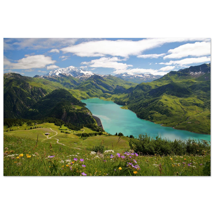
Photo print of Lake Roselend and Mont-Blanc from Roche Parstire in the Beaufortain
From Roche Parstire, Lake Roselend is nestled between the alpine pastures of the Beaufortain and the distant peaks. Photography by Christophe Cappelli. Discover this photo print of Roselend.

The essentials in 30 seconds

  • Best viewpoint: Roche Parstire, to overlook Lake Roselend and view the Beaufortain in multiple planes.
  • Best area for panoramas: Col du Pré and the heights of Roselend, with its roads, alpine pastures, and reservoir.
  • Best graphic subject: Lake and dam of Saint-Guérin, particularly interesting from elevated points.
  • Most readable light: Morning or late afternoon, when shadows separate the ridges and add relief to the alpine pastures.
  • Useful focal lengths: 24–70 mm for structuring landscapes, 70–200 mm for isolating peaks, shores, and dam curves.
  • Essential tip: Choose a main subject before framing: the lake, a ridge, the road, the dam, or a precise relationship between several planes.

Why is this area so interesting for photography?

Roselend and Saint-Guérin are reservoir lakes, but their photographic interest extends far beyond the presence of the dams. In the Beaufortain, hydraulic structures integrate into a landscape of alpine pastures, ridges, and open valleys. Human lines are visible, but they don't necessarily dominate the image. On the contrary, they can serve as landmarks, provide a sense of scale to the relief, or guide the eye.

Lake Roselend produces the broadest landscapes. Its irregular shape, carved shores, and the roads overlooking it allow for varied framing without completely changing the area. From Roche Parstire, the lake becomes a large blue motif set at the bottom of the alpine pastures. From Col du Pré or nearby roads, it takes up more space in the composition and interacts with the nearby slopes.

Saint-Guérin offers a more compact atmosphere. The reservoir is surrounded by closer reliefs, and the dam forms a highly identifiable line. The footbridge, shores, and paths provide accessible subjects without having to seek out an immense panorama. This is a good area for working on details, diagonals, and contrasts between water, concrete, rock, and vegetation.

Finally, Roche Parstire visually connects both worlds. The ridge overlooks Roselend on one side and the Arêches valley on the other. It helps understand the organization of the massif and build a series that isn't limited to a classic lake view.

Which location to choose depending on the desired image?

Area Main subjects Atmosphere Useful focal lengths Vigilance point
Roche Parstire Lake Roselend, Mont-Blanc, Pierra Menta, ridges and alpine pastures Panoramic and aerial 24–70 mm, 70–200 mm Panorama too wide, ridge path and wind
Col du Pré Lake, dam, road, alpine pastures and terrain lines Open and graphic 35–135 mm Parking, traffic and frontal light
Roselend Valley Panoramas, pastures, roads and successive reliefs Pastoral 35–100 mm Accumulation of elements and empty sky
Roselend shores and dam Water, structure, chapel, curves and mountains Monumental 24–70 mm, 70–200 mm Too frontal perspective and high contrast
Saint-Guérin Dam, footbridge, lake, shores and plunging views Intimate and graphic 24–120 mm Crowds, harsh shadows and aerial restrictions

If you only have half a day and are looking for an instantly recognizable image, Roche Parstire and Col du Pré are the most effective choices. For a more varied or graphic series, Saint-Guérin provides a useful complement. Roselend can be treated as a grand landscape; Saint-Guérin often works better with a tighter selection of shapes and details.

Access and organizing a photo outing

The area heavily relies on mountain roads subject to snow, construction, and seasonal conditions. Before any outing, consult the official road conditions for Arêches-Beaufort and Savoie Route. Do not plan your itinerary around a pass without having a fallback solution in the valley.

For Roche Parstire, the classic route starts from Col du Pré. The official description indicates a loop of about 8.3 kilometers and 640 meters of positive elevation gain. The trail begins in the forest, quickly reaches open areas, then follows a ridge offering continuous views of Lake Roselend and the massif. These figures give a good order of magnitude, but they do not replace evaluating the day's conditions.

Roselend can also be photographed from several road points and trails near Col du Pré, the dam, and Plan de la Lai. This accessibility should not lead to parking outside designated areas. The roads are used by locals, farmers, cyclists, and technical vehicles.

At Saint-Guérin, the parking lot near the dam provides access to a walk along the reservoir and the footbridge. This is a simpler area for a short outing, but the light can be very contrasted in the middle of the day. A visit early in the morning or late in the afternoon often improves the readability of the shores and the relief.

Photographing Roche Parstire and its panorama

Roche Parstire offers the most comprehensive viewpoint in the area. The ridge dominates Lake Roselend and opens up a succession of planes ranging from nearby alpine pastures to the grand reliefs of the Beaufortain. On a clear day, Mont-Blanc and Pierra Menta can be part of the same panoramic view, but they don't necessarily have to appear together in every image.

The first mistake is to photograph the panorama only with a very wide-angle lens. The spectacle seems immense on site, but too short a focal length reduces the lake and peaks to small, scattered elements. Instead, start around 35 or 50 mm to find a clear relationship between the ridge, the lake, and an identifiable relief. Then switch to 70–200 mm to isolate mountain layers, reservoir curves, or a distant peak.

The ridge offers several foregrounds: grass, rocks, a trail, breaks in the slope, and silhouettes of hikers. Use them sparingly. A foreground is only useful if it leads towards the lake or gives scale to the landscape. A large area of indistinct grass, on the other hand, can push the main subject to the edge of the image.

Side lighting is particularly effective. It separates the folds of the alpine pastures and prevents the lake from becoming a simple uniform patch. When the sky is very clear, a tighter framing on the relief can be stronger than a view incorporating a large expanse of empty sky.

On the ridge, the wind can be significantly stronger than at the start. Maintain a sufficient shutter speed, stabilize your tripod, and avoid placing light equipment on the ground. The hike also crosses pastoral areas: stay on the path and do not approach herds to create an artificial foreground.

Photographing Lake Roselend

Lake Roselend changes dramatically depending on the viewpoint. From above, its shape becomes a graphic motif. Closer to the reservoir, it's the shores, the dam, the chapel, and the surrounding reliefs that structure the image. Before shooting, decide if the lake is the main subject or just a connecting element between the mountains.

For a wide shot, look for a shoreline that leads the eye towards a peak or the bottom of the valley. The lake's curves are more effective than perfectly frontal framings. A slight offset often allows the reservoir to enter diagonally and avoids a too static composition.

The water's color depends on the light, clouds, and shooting angle. Spectacular turquoise is not guaranteed and should not be forced in post-processing. A darker water, on the contrary, can enhance the contrast with the alpine pastures or warm light on the ridges.

The dam can be integrated as a horizontal line or an architectural mass. It provides a considerable scale to the landscape but can become too dominant if the framing cuts off the reliefs. A medium focal length often helps maintain balance between the structure, the reservoir, and the mountains.

Roselend Chapel can serve as a secondary subject and recall the valley's inhabited history. However, avoid accumulating the lake, dam, chapel, road, and several peaks in the same image. Two or three well-connected elements generally produce a stronger photograph.

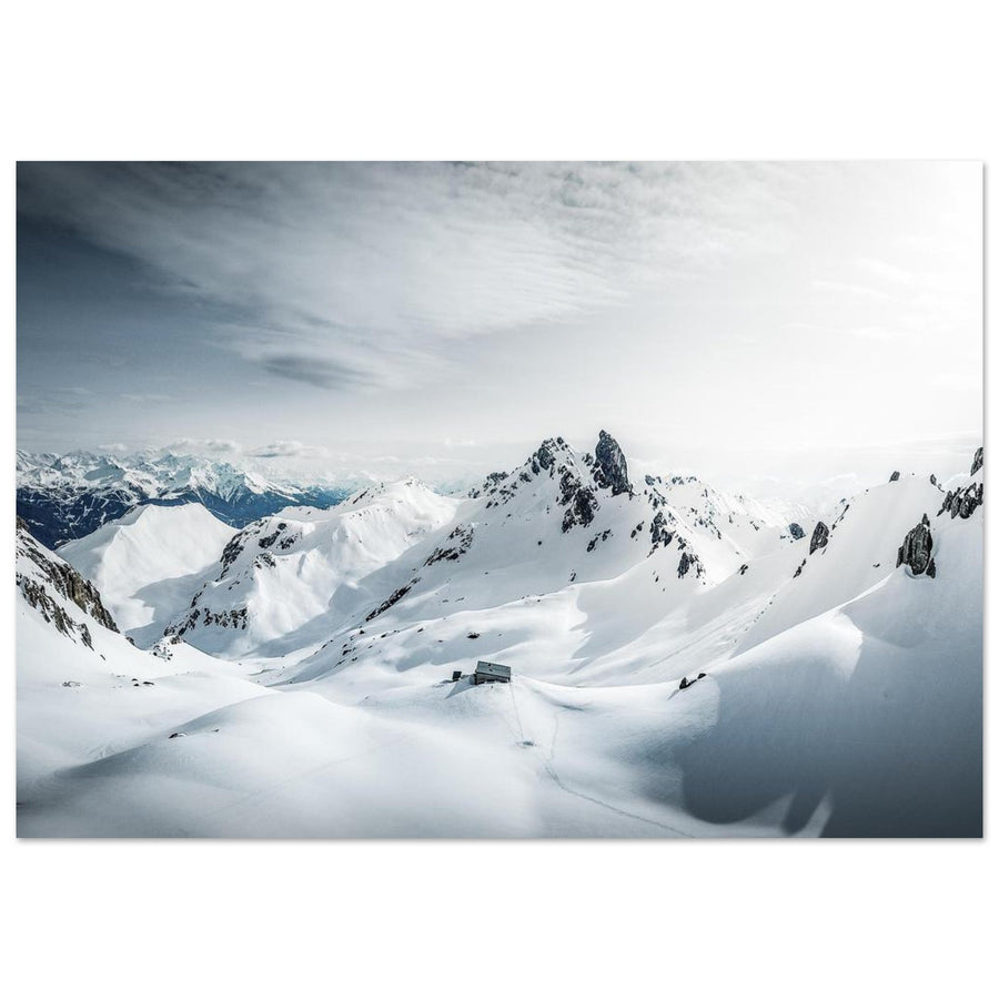
Panoramic photo print of the Roselend valley in the Beaufortain, Savoie
The Roselend valley combines alpine pastures, reliefs, and circulation lines in a very open landscape. Photography by Denis Belitsky. Discover this Roselend photo print.

Photographing the Roselend valley and roads

The Roselend valley is interesting when you want to show the entire territory rather than just one viewpoint. The roads, meadows, and relief lines allow for constructing panoramic images where human activity remains discreet but visible.

A road can serve as a leading line, provided it actually leads towards the subject. Avoid framings where it abruptly enters the image only to disappear behind an embankment. Instead, look for a complete curve or a series of bends that complement the landscape's depth.

The alpine pastures add color and a seasonal interpretation. In summer, green can become very dominant; a low light or a framing that includes more rock can rebalance the palette. When herds are present, they can provide scale to the landscape, but should never be moved, approached, or disturbed for photography.

The panoramic format is well suited to the area, but it should not become automatic. A vertical image can be more effective for connecting a low bank, a slope, and a summit. The choice of format should follow the lines of the terrain rather than a habitual shooting style.

Photographing Lake and Dam of Saint-Guérin

Saint-Guérin does not evoke the same sense of immensity as Roselend. Its interest lies more in the proximity of elements and compositional possibilities. The dam, the footbridge, the shores, and the reliefs surrounding the reservoir create clear lines that work well with a medium focal length.

From the dam's surroundings, look for contrasts between man-made forms and natural lines. The footbridge can become a graphic subject or give scale to the lake, but it immediately draws the eye. Place it precisely and avoid it awkwardly cutting a peak or a shore.

Plunging views are particularly interesting. They reveal the water's color variations and the reservoir's geometry. A long focal length allows isolating a shoreline curve, a portion of the dam, or a boat without losing the mountainous character of the place.

Midday light can be harsh, especially when nearby slopes create large shadow areas. A slightly overcast sky or lower light generally provides a smoother transition between water, vegetation, and rocks.

The official discovery walk starts from the Saint-Guérin parking lot, reaches the dam, then follows part of the lake towards the footbridge. It offers several accessible points, but keep in mind that the area can be busy. For a calm series, prefer the first or last hours of the day.

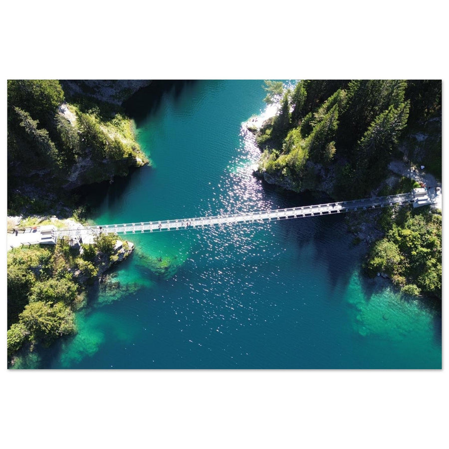
Aerial photo print of Lake Saint-Guérin in the Beaufortain massif
High-altitude view of the curves of Lake Saint-Guérin in the heart of Beaufortain. Photography by laetom_drone. Discover this photo print of Saint-Guérin.

Aerial views and graphic interpretation of dams

Aerial photographs immediately reveal the geometry of Saint-Guérin. The curves of the shores, the line of the dam, and the variations in water color become clearer. However, they should not be seen merely as a way to get a spectacular angle.

A good aerial framing maintains a connection with the mountain. If the image is limited to a body of water and a section of dam, it can lose its context and become almost abstract. This approach can be intentional, but it must be acknowledged. For a Beaufortain landscape, generally keep a shore, a slope, or a recognizable relief in view.

Drone regulations depend on the exact area, altitude, temporary restrictions, presence of people, and rules applicable to structures. Always consult the official flight restriction map before any trip and check for local prohibitions. The presence of aerial photographs in the catalog never constitutes a general authorization to fly in the same location today.

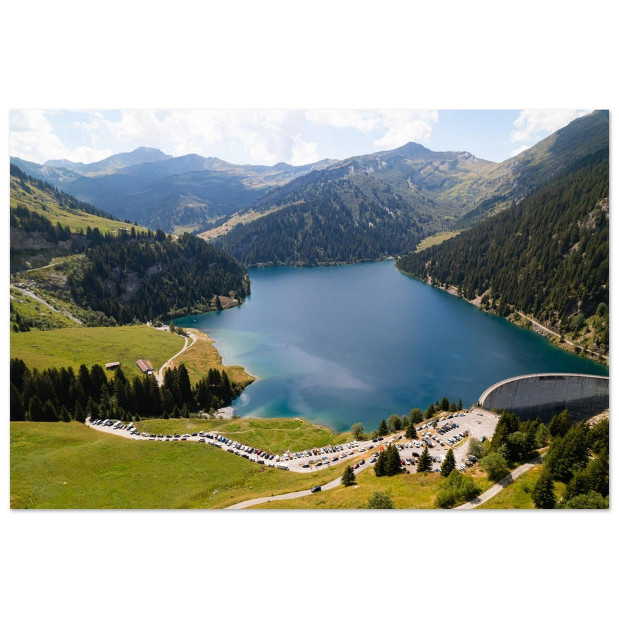
Aerial photo print of Lake and Dam of Saint-Guérin in Beaufortain
The aerial view highlights the relationship between the dam, the reservoir, and the Beaufortain mountains. Photography by SYLVAIN FELTEN. Discover this photo print of the Saint-Guérin dam.

Sunrise, sunset, and light conditions

The area does not have a single simple orientation. The slopes, ridges, and valleys create different shadows depending on the viewpoint. Favorable light at Roselend might be less interesting at Saint-Guérin at the same time. It is therefore useful to prepare each outing with a topographic map and a sun position application.

Mornings often offer a calmer atmosphere, less wind, and better visibility of distant peaks. This is a good time for panoramas from Roche Parstire or lake views from the heights. In the late afternoon, the alpine pastures can receive warmer light, while the reservoirs become darker and denser.

Partially cloudy days are often the most interesting. Glimpses of light isolate a shore, a slope, or part of the lake and avoid the uniformity of a perfectly blue sky. However, watch out for clouds clinging to the ridges: they can quickly obscure the panorama and reduce visibility.

After a disturbance, the air can be clearer and the peaks more distinct. However, conditions change rapidly in the mountains. Always leave enough margin to descend before nightfall and do not stay on an exposed ridge if the weather becomes unstable.

Which season to choose?

Early summer offers very green alpine pastures, flowers, and sometimes residual snowfields. Color contrasts are strong, but roads and trails may still depend on snow clearing.

Mid-summer makes access to passes and hikes easier. This is the simplest period to combine Roche Parstire, Roselend, and Saint-Guérin, but also the busiest. Morning outings allow for more calm.

Early autumn brings lower light, softer tones in the alpine pastures, and generally reduced crowds. Days shorten quickly, and the first winter conditions can arrive early at high altitudes.

Winter completely transforms the area, but usual road access may be closed. Winter photography then requires specific preparation, an adapted itinerary, and an assessment of snow-related risks. Summer routes should not be directly transposed.

Compositions and focal lengths

The 24–70 mm for building the landscape

This range covers most scenes. Around 35 to 50 mm, it allows integrating the lake, a foreground, and a ridge without making elements too distant. The 24 mm becomes useful when a nearby line, like a shore or a path, truly structures the image.

The 70–200 mm for simplifying

The telephoto lens is essential from Roche Parstire. It brings relief layers closer, isolates a portion of the lake, and allows building a composition around a single peak. At Saint-Guérin, it is used to extract the curves of the reservoir and the details of the dam.

The vertical format

The vertical format works well when the composition connects a low foreground to a ridge or a peak. It can also enhance the depth of a slope descending towards the lake. Don't systematically reserve panoramas for the horizontal format.

Reflection as a secondary subject

Large reservoirs do not always yield perfect reflections. Wind and the shape of the shores make the surface changeable. Use the reflection when it provides a clear structure, without expecting absolute symmetry.

Three outing strategies

Strategy 1: panorama from Roche Parstire

Leave early, when visibility is good and the wind is still moderate. First, work on the wide view, then quickly switch to the telephoto lens to isolate Roselend, Mont Blanc, or Pierra Menta. On the way back, complete the series with the alpine pastures and views towards the Arêches valley.

Strategy 2: Roselend from the road and Col du Pré

This option is suitable for a shorter outing. Look for several vantage points around the pass and the dam, without making too many dangerous stops. Build a series around the curves of the lake, the road, and the relief rather than a succession of identical postcards.

Strategy 3: Saint-Guérin in soft light

Arrive early or late in the day. Start with the dam and general views, then walk along the reservoir towards the footbridge. Use the telephoto lens for details and keep some wider shots to place the structure in its mountain environment.

Recommended equipment and settings

  • Camera body: any camera capable of working cleanly between 24 and 200 mm is suitable.
  • Lenses: 24–70 mm and 70–200 mm form the most versatile duo.
  • Tripod: useful at dawn, dusk, and when the wind remains moderate.
  • Polarizing filter: to be used with caution, as its effect varies greatly in a wide panorama.
  • Protection: wind jacket, spare battery, and light protection against moisture.

For a sharp landscape, start around f/8 and adjust the aperture to the actual depth of the scene. Keep the ISO sensitivity as low as possible without sacrificing speed. On a windy ridge, a faster shutter speed and a series of sharp images are better than a theoretically long but unstable exposure.

On water and residual snow, monitor the histogram. Keep detail in the highlights and avoid underexposing shaded slopes excessively. Light bracketing can be useful when the luminosity difference is significant, but it does not replace well-chosen light.

Safety, pastoralism, dogs and drones

Roche Parstire includes ridge passages that require attention, especially with wind, wet ground, or reduced visibility. Adapt the outing to the group's level and never back towards the void while only looking at the camera screen.

Beaufortain is an active pastoral area. Stay on paths, close fences, do not obstruct agricultural vehicles, and maintain a significant distance from herds. The tourist office requests that dogs be kept on leash in mountain environments to protect wildlife and avoid incidents with livestock.

Parking must be limited to authorized spaces. The narrow shoulders around lakes and passes are not permanent photo spots. If a framing requires obstructing traffic or agricultural activity, it must be abandoned.

For drones, consult official restrictions before each flight. Also check for the presence of people, specific rules for structures, wildlife, herds, and temporary restrictions. A successful aerial view never justifies an unauthorized flight or risk-taking.

Beaufortain photo prints

The gallery brings together several landscapes from this area: Lake Roselend from Roche Parstire, the Roselend valley, and two different aerial interpretations of Lake Saint-Guérin. The photographs are offered as Beaufortain photo prints on matte aluminum Dibond, made to order.

The second cluster guide will extend this selection to Lake Presset, the refuge, and Pierra Menta, in a more mineral and challenging atmosphere.

FAQ

What is the best viewpoint of Lake Roselend?

Roche Parstire offers the most complete view, with the lake below, alpine pastures, and several major peaks. Col du Pré is more accessible and allows for closer framing of the reservoir and roads.

How to access Roche Parstire?

The classic route starts from Col du Pré. The official guide announces a loop of approximately 8.3 kilometers with 640 meters of positive elevation gain. Conditions and road openings must be checked before departure.

What is the best time to photograph Roselend?

Morning and late afternoon generally provide more relief to the alpine pastures and ridges. However, the best time depends on the viewpoint and cloud cover.

Can Saint-Guérin be photographed without a long hike?

Yes. The parking lot near the dam provides access to a walk along the reservoir and towards the footbridge. Several compositions are possible without a long hike.

What focal length to use at Roche Parstire?

A 24–70 mm is suitable for structured landscapes, but a 70–200 mm is particularly useful for isolating relief layers, the lake, and distant peaks.

Is Lake Roselend accessible all year round?

High-altitude road accesses are subject to seasonal closures and variable conditions. Consult the official road status before any outing.

Are dogs allowed in the area?

Rules may vary depending on the routes. In the mountain environment around Arêches-Beaufort, dogs must be kept on a leash, and some hikes may be prohibited for dogs. Check the chosen route's information sheet.

Can I fly a drone at Roselend or Saint-Guérin?

There is no general authorization. The possibility of flying depends on the exact area, aerial restrictions, people present, structures, and temporary rules. Consult the official map before each flight.

Back to blog